— Article
How Drones Are Transforming Public Safety in 2026
For most of the last century, getting eyes in the sky during an emergency meant one thing: a helicopter. Loud, expensive, slow to mobilize, and out of reach for most small agencies, aerial support was a luxury reserved for well-funded departments in major cities. A patrol officer in a rural county, a search and rescue team in the mountains, a fire crew monitoring a wildfire in a remote canyon — for these teams, aerial awareness was either unavailable or arrived too late to matter.
That reality has shifted in a fundamental way over the past several years. Drones have placed real-time aerial capability in the hands of agencies that could never afford a helicopter program, and they have done it at a fraction of the cost, with faster deployment times, and with sensor packages that in some scenarios outperform their manned counterparts. The transformation is not theoretical. It is playing out on the streets, in forests, along coastlines, and over disaster zones right now, and the scale of adoption tells you everything you need to know about how valuable this technology has become.
The Numbers Behind the Shift
Public safety agencies across the United States now operate more than 7,000 unmanned aircraft system programs. Compare that to roughly 300 traditional aviation units still relying on helicopters or fixed-wing aircraft. That gap reflects a simple economic and operational reality: drones give agencies aerial capability at a cost that is actually manageable.
A police helicopter can run up to four million dollars to purchase and costs somewhere between three thousand and five thousand dollars every single hour it flies. A purpose-built public safety drone costs between fifty thousand and two hundred thousand dollars and operates for somewhere between twenty-five and one hundred dollars per hour, representing a cost reduction of around ninety-five percent compared to traditional aviation. For a small sheriff’s office or a volunteer search and rescue team working on a tight annual budget, those numbers are not just attractive. They are the difference between having aerial support at all and not having it. For a deeper look at how these cost comparisons translate into budget decisions, our ROI breakdown for UAS in emergency response covers the full financial picture.
The commercial drone fleet in the United States is now expected to exceed one million aircraft, with the FAA projecting continued growth toward 1.18 million by 2029. Drones are currently the fastest-growing segment of U.S. aviation, and public safety is one of the primary drivers pushing that growth.
Drone as First Responder: The Model Changing Emergency Response
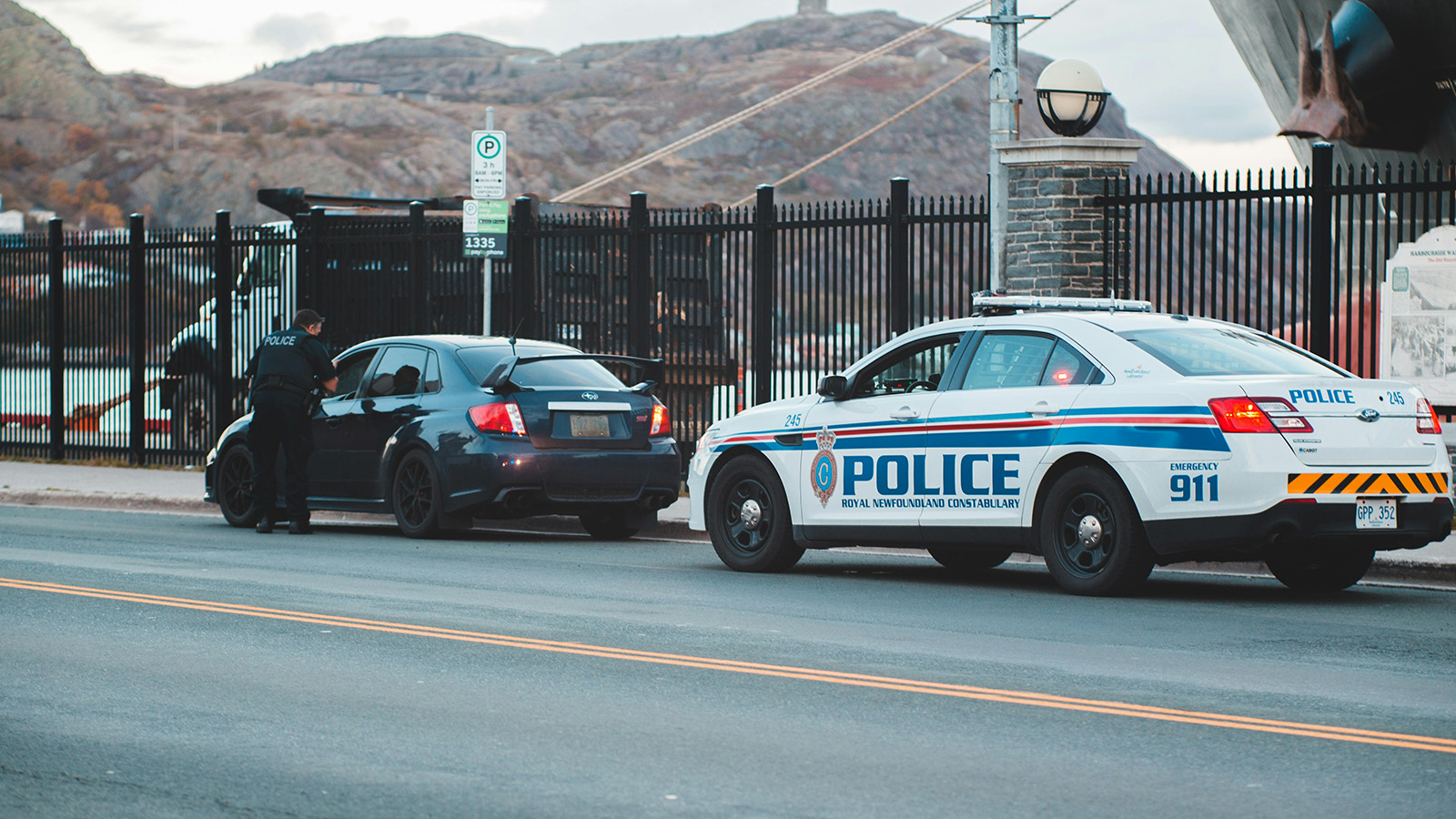
The most significant operational development in public safety drone use is what the industry calls the Drone as First Responder model. The concept is straightforward: when a 911 call comes in, a drone launches immediately from a pre-positioned station and arrives on scene before any ground unit.
The Chula Vista Police Department in California pioneered this model, and their results are hard to argue with. Their program has logged more than 18,000 responses, achieved an average on-scene arrival time of 94 seconds, assisted with more than 2,500 arrests, and placed a drone on scene before any ground unit more than 13,500 times. In roughly one out of every four calls, the drone gathers enough information to clear the ground unit entirely, freeing patrol officers to respond to something else.
Captain John English of the Chula Vista department captured the cultural shift that follows when this technology becomes embedded in daily operations: officers who were initially skeptical eventually came to expect drone coverage as a standard part of how they respond. It stopped being a novelty and became infrastructure.
After years of slow regulatory progress, the FAA updated its rules for Drone as First Responder programs in May 2025, significantly streamlining the authorization process. That single rule change pushed the number of authorized DFR programs from around 50 accumulated over the previous six years to nearly 600 within months. 2025 may well be remembered as the year this model went from early adoption to mainstream practice.
Situational Awareness Before Anyone Puts Boots on the Ground
One of the clearest benefits drones deliver is something that sounds simple but changes outcomes at a fundamental level: knowing what you are walking into before you walk into it.
For law enforcement, that means getting a live aerial view of a standoff, a vehicle pursuit, or an active scene before officers arrive. In tactical situations, drones have been used to see into windows, identify the number and location of occupants, confirm whether a threat is armed, and assess the safest approach routes. In at least one documented case, drone footage revealed that a suspect was reaching for a firearm during a standoff, allowing officers to respond appropriately before anyone was harmed.
For fire departments, aerial awareness means being able to see the full perimeter of a structure fire, identify secondary hazards, and monitor roof conditions without putting a firefighter in a position they cannot safely exit. Thermal imaging mounted on a drone can locate hotspots through smoke and debris, identify whether a fire has jumped a containment line, and detect heat signatures inside structures that look stable from the outside.
For search and rescue teams, the value of a drone with a thermal camera during a night operation is difficult to overstate. Human beings stand out clearly against cooler terrain when viewed through infrared imaging. Areas that would take a ground team hours to systematically search can be covered by a drone in minutes. DJI reported that in a single year, drones equipped with thermal sensors were directly responsible for saving 279 lives during emergency search operations.
A Force Multiplier for Understaffed Agencies
One of the persistent realities facing public safety agencies today is that they are operating with fewer personnel than their communities need. Drone programs do not solve the staffing problem, but they do allow agencies to accomplish more with the people they have.
The road accident documentation example is a useful illustration. After a serious vehicle accident, law enforcement traditionally needed officers on scene for roughly four hours to document the incident thoroughly enough to support an investigation. A drone can complete the same documentation task in about fifteen minutes, capturing aerial photography and video that is often more detailed and defensible than what officers can gather from ground level. Those four hours of officer time get redirected to other calls.
In crowd management situations, a single drone operator can monitor a large event from altitude and provide real-time intelligence to dozens of officers positioned throughout the venue. The drone becomes a coordination tool that extends every officer’s field of view simultaneously.
For search and rescue teams specifically, the force multiplication effect is dramatic. Rather than deploying volunteers into potentially dangerous terrain to conduct a systematic ground search, coordinators can use drones to cover the highest-probability areas first, focusing human resources on locations where there is actual evidence of a subject. Teams that once took hours to search a grid can now clear or prioritize large areas within the first thirty minutes of a deployment. Choosing the right search pattern for the terrain and subject profile is what makes that coverage systematic rather than ad hoc.
What the Sensors Make Possible
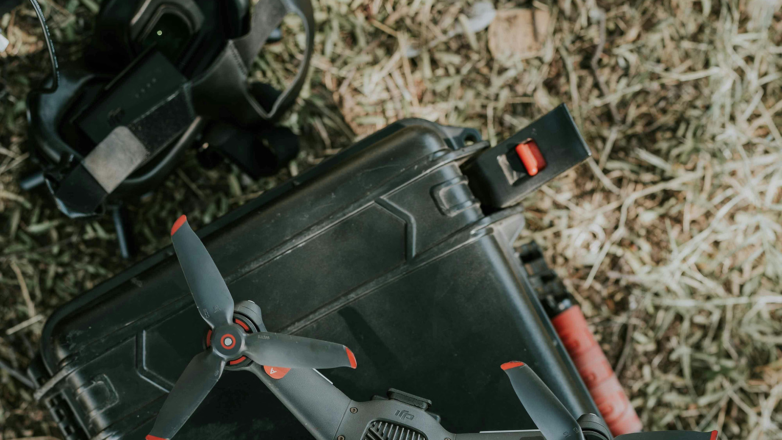
A drone is a platform. What it can do is largely determined by what it carries. Modern public safety drones can be configured with high-resolution optical cameras, thermal and infrared imagers, powerful zoom lenses, spotlights, two-way audio systems, and speakers capable of broadcasting instructions over a wide area.
Thermal imaging in particular has opened up capabilities that simply did not exist before for most agencies. Heat signatures penetrate smoke, darkness, foliage, and light debris in ways that optical cameras cannot. A thermal sensor can locate a missing person hiding under tree cover, identify a fleeing suspect in near-total darkness, map the heat signature of a wildfire spreading through dry brush, or help firefighters understand where a blaze is burning hottest inside a structure.
Understanding the difference between thermal and optical payload types — and when each one is the right choice — is what separates programs that get consistent results from those that are guessing.
Some agencies are beginning to integrate AI-assisted detection into their drone operations, with onboard systems capable of flagging human forms in live video feeds and alerting operators to potential subject detections in real time. This capability reduces operator fatigue during extended search operations and improves the probability of detecting a subject before the aircraft has to make another pass.
Disaster Response and Large-Scale Operations
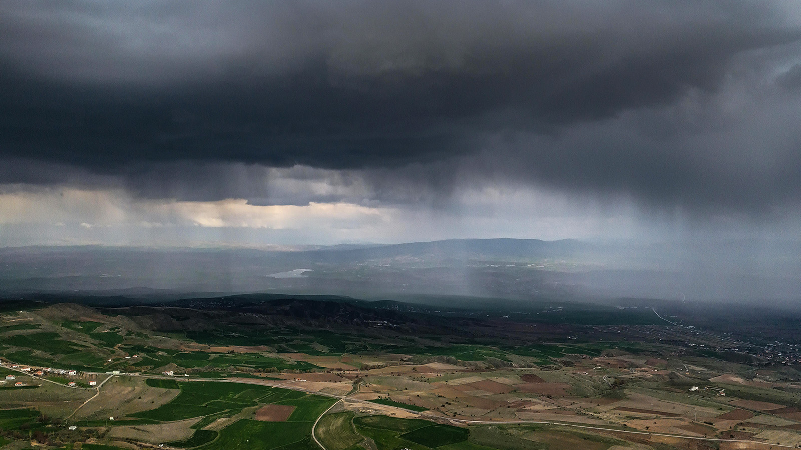
When a disaster strikes, the first question emergency managers need answered is: what is the actual scope of what we are dealing with? Helicopters have historically provided that aerial reconnaissance capability, but they come with operational constraints that drones do not share.
A drone can be launched within minutes, can fly low and slow over affected areas, can transmit live video to an emergency operations center, and can cover routes that a helicopter cannot safely navigate. After a flood, a drone can assess road passability, identify where survivors may be isolated, and map the extent of damage before ground teams are deployed into conditions that may not be safe. After a wildfire, a drone can survey hundreds of structures in a fraction of the time a ground crew would require.
Following major disasters, agencies have used drone footage to compile damage assessments that support FEMA documentation, provide evidence for insurance claims, and inform the prioritization of recovery resources. The aerial perspective a drone provides in the hours after a disaster often shapes the entire response strategy for the days that follow.
For operations involving multiple drone teams across a large disaster area, having a command and control platform that provides a shared operational picture becomes the difference between coordinated response and parallel efforts that duplicate coverage while leaving gaps.
The Road Ahead
The momentum behind public safety drone adoption is not slowing down. Beyond visual line of sight operations, which allow drones to fly further than the operator can directly observe, are moving from waiver-based exceptions toward normalized practice as the FAA finalizes new rules that were proposed in August 2025. This will significantly expand the geographic coverage that drone programs can deliver on a single deployment.
AI-assisted detection, autonomous patrol routes, and integration with existing dispatch and communications infrastructure are all maturing rapidly. The next phase of drone use in public safety is not simply more agencies operating more drones. It is deeper operational integration, where drone data feeds directly into the decision-making tools that commanders and coordinators use in real time.
The agencies that are building their programs now — establishing standard operating procedures, training operators, and learning how to integrate aerial data into their operational workflow — are the ones that will be best positioned to take advantage of what comes next. For a roadmap on how to stand up that capability from scratch, our guide to building a drone SAR program from the ground up covers the full seven-phase build sequence.
Understanding which type of drone fits which mission profile — and how to match platform to mission — is the next step after deciding to build the capability.
For those that have not yet started, the barrier to entry has never been lower. The cost per flight hour makes experimentation possible. The technology is proven. The case studies are no longer hypothetical. Across law enforcement, fire response, search and rescue, and emergency management, the agencies doing this work have made the same observation: once you have reliable aerial awareness during an operation, going back to working without it is not something anyone wants to do.
We’re building TacLink C2 to be the command and control layer for this next phase — fleet-wide coordination, shared situational awareness, and operational integration that turns individual drone flights into a unified program. If you’re building or scaling a public safety drone operation, join the early access waitlist.
— Related
Keep reading
Written by
TacLink C2 Team
TacLink C2 Team builds a modern desktop ground control station for independent and commercial drone pilots. Writing here covers mission planning, multi-drone operations, airspace, and the software that keeps serious UAS programs running.