— Article
5 Drone Search Patterns for SAR: When to Use Each One
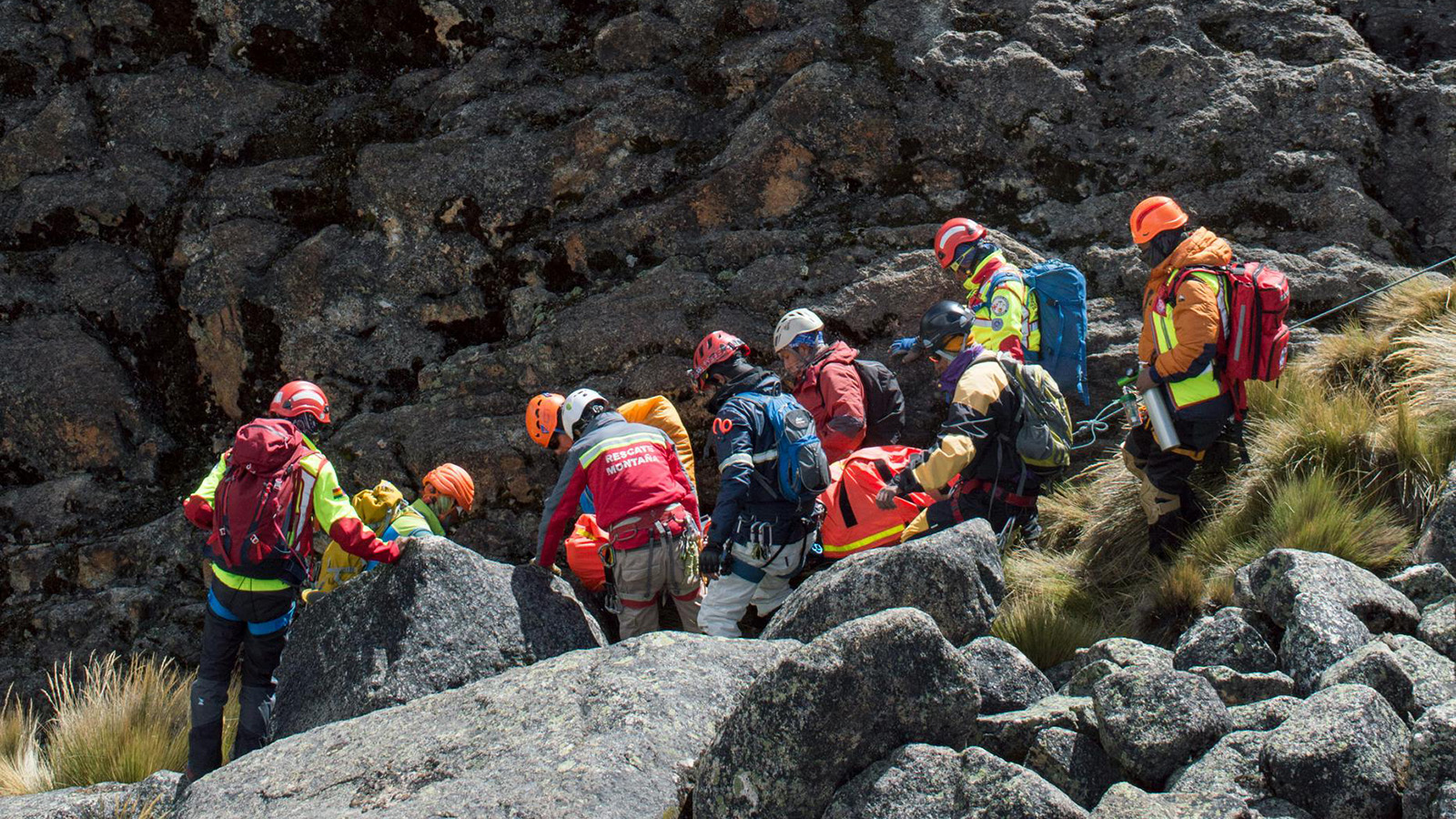
A drone without a search pattern is just a camera in the sky. It might find something by chance, but it can’t tell you what it’s already covered, what it’s missed, or how confident you should be in the result. In search and rescue, that distinction matters — because when you report an area as “cleared,” people make life-or-death decisions based on that word.
Structured search patterns are the foundation of systematic SAR operations. They’ve been used by maritime and aviation search teams for decades, codified in manuals like the IAMSAR (International Aeronautical and Maritime Search and Rescue) and adapted by ground SAR teams worldwide. Drones didn’t invent these patterns — but they’ve made executing them faster, more precise, and more repeatable than a human walking a grid line ever could.
This article covers the five primary search patterns used in drone SAR operations, when each one is the right choice, and the variables that should drive your selection.
The Variables That Drive Pattern Selection
Before choosing a pattern, you need to answer four questions. Every pattern decision flows from these:
How confident are you in the subject’s location? If you have a strong last known point (LKP) — a cell phone ping, a vehicle at a trailhead, a witness sighting — you’ll want a pattern that concentrates effort near that point and works outward. If the LKP is weak or the subject is highly mobile, you need a pattern that covers area uniformly.
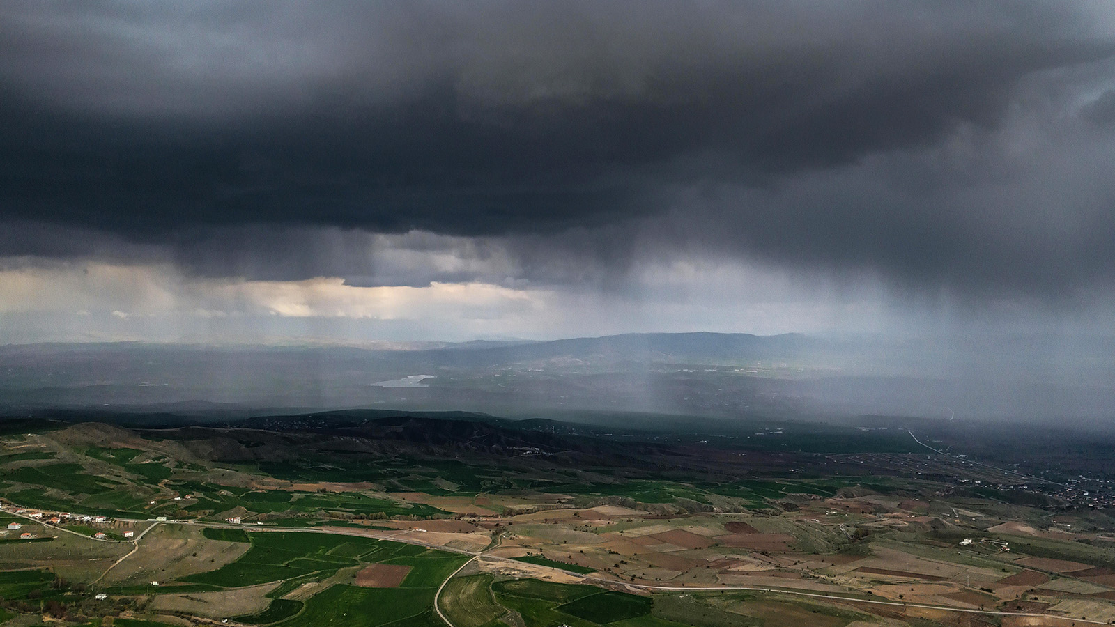
What does the terrain look like? Flat, open terrain allows for clean geometric patterns with consistent track spacing. Mountainous terrain with steep elevation changes, canyon walls, and dense canopy requires patterns that follow the landscape rather than fight it. The pattern that works on a prairie will get you killed in the Rockies — or at minimum, get your aircraft killed.
What sensor are you using? The camera’s field of view and the required ground sample distance determine your track spacing — the distance between parallel flight lines. A wide-angle visual camera at 200 feet AGL covers a different swath than a narrow-FOV thermal sensor at the same altitude. Your track spacing must ensure overlap between adjacent passes, or you’ll have blind strips running the length of your search area.
How much time and battery do you have? Some patterns are more efficient than others for a given area. An expanding square burns more flight time on turns than a parallel track covering the same ground. When battery cycles are limited, efficiency matters. When you’re coordinating multiple aircraft across a large operation, pattern efficiency directly affects how many sectors you can cover before sunset — or before the next battery rotation.
The Five Core Search Patterns
1. Parallel Track (Ladder Search)
What it is: The aircraft flies back and forth in evenly spaced parallel lines across the search area, like mowing a lawn. Each pass is separated by a fixed track spacing determined by sensor swath width and desired overlap.
When to use it: This is the workhorse pattern for defined rectangular or polygonal search areas where you need uniform coverage and no particular zone is higher priority than another. It’s the default choice when the subject’s location is uncertain within the assigned sector, and you need systematic, documentable coverage.
Strengths: Simple to plan and execute. Easy to automate with waypoint-based flight planning. Produces clean, measurable coverage with consistent track spacing. Works well for both visual and thermal sensors. Straightforward to calculate probability of detection after the fact because the geometry is uniform.
Weaknesses: Doesn’t prioritize any area over another — if you have a high-probability zone within the sector, the parallel track treats it the same as everywhere else. Also, the pattern doesn’t adapt to terrain. On flat ground, it’s ideal. On a mountainside, maintaining consistent AGL altitude while flying parallel tracks requires the autopilot to chase terrain aggressively, which increases battery consumption and can produce erratic flight behavior.
SAR application: Best for initial systematic coverage of well-defined sectors where the search management team has assigned boundaries but no strong probability weighting within the sector. This is the pattern you’ll use most often.
2. Creeping Line
What it is: Functionally identical to the parallel track, but the flight lines are oriented along the short axis of the search area rather than the long axis. The aircraft makes shorter passes but more of them, “creeping” across the sector from one end to the other.
When to use it: When you want to prioritize one end of the search area over the other. If the subject was last seen entering the north end of a valley, a creeping line starting from the north ensures that the highest-probability ground gets searched first — before batteries run out or conditions change.
Strengths: Allows you to sequence coverage by priority within a rectangular area. Same planning simplicity as parallel track. Also useful when environmental factors favor a specific orientation — for example, flying perpendicular to sun glare on water, or aligning search legs with a prevailing wind direction for more stable flight.
Weaknesses: Same terrain limitations as parallel track. Shorter legs mean more turns, which means more time spent maneuvering and less time spent with the sensor pointed at the ground.
SAR application: Use when you have a directional bias — you know (or strongly suspect) which end of the sector the subject entered from, or when you want to search the most accessible terrain first and work toward more challenging ground.
3. Expanding Square
What it is: The aircraft starts at a center point — typically the last known position or the highest-probability point — and flies outward in a square spiral pattern. Each leg is slightly longer than the previous one, expanding the search area concentrically from the center.
Strengths: Concentrates initial effort at the highest-probability location and works outward systematically. No area near the center gets skipped. Good for initial “reflex” flights when a mission launches and you want to search the immediate area around the LKP before committing to a full sector plan.
Weaknesses: The geometry gets less efficient as the square expands — longer legs mean more time in transit between useful sensor passes. Also, the pattern doesn’t fill non-square areas well. If your search area is a long, narrow valley, an expanding square wastes significant flight time covering ground outside the actual area of interest. Battery consumption scales poorly with large search areas.
When to use it: When you have a high-confidence LKP and want to search the immediate vicinity first. Common for initial deployment when the mission briefing identifies a strong starting point — a dropped backpack, a cell phone ping, a last-seen location from a witness. Also useful when the search area hasn’t been formally defined yet and you need to start flying while the search management team finalizes sector assignments.
SAR application: First-on-scene reflex pattern. Launch, fly to the LKP, expand outward. If the subject is close by, you’ll find them fast. If not, you’ll have cleared the immediate area by the time the broader search plan is ready.
4. Sector Search (Pie Slice)
What it is: The search area is divided into pie-shaped wedges radiating from a center point. The aircraft flies outward along one radial, turns, flies back through the center, and continues outward along the next radial. The result is a series of passes that all cross through the center point from different angles.
Strengths: Every pass crosses the highest-probability point, giving it the highest cumulative detection probability of any pattern. Excellent for small, well-defined areas where you’re highly confident the subject is within a tight radius.
Weaknesses: Coverage is densest at the center and thinnest at the perimeter — the gaps between radials grow wider as you move outward. This makes it a poor choice for large areas. It’s also awkward to automate compared to parallel tracks, since the flight path involves constant heading changes rather than long, straight legs.
When to use it: When you have a very high-confidence point — someone fell through ice at a known location, a beacon signal is pinpointed to a small radius, or a witness saw the subject in a specific clearing. The sector search maximizes your chances of detecting something at or very near that point.
SAR application: Tight-radius, high-confidence searches. Not a common first choice for wilderness SAR where search areas tend to be large, but valuable for targeted searches around specific clues or signals.
5. Contour Search
What it is: The aircraft follows the contour lines of the terrain, flying at a constant altitude above ground level while circling a mountain, ridge, or valley wall. Rather than imposing a geometric pattern onto the landscape, the contour search adapts to it.
Strengths: This is the only pattern that works well in steep, mountainous terrain where parallel tracks would require extreme altitude changes between passes. By following the terrain at a constant AGL, the sensor maintains a consistent ground sample distance and the aircraft avoids the dangerous altitude excursions that geometric patterns demand in rugged country.
Weaknesses: Difficult to plan and nearly impossible to automate with basic waypoint tools. Requires either manual piloting skill or advanced terrain-following autopilot capability. Coverage documentation is harder — it’s not as easy to calculate track spacing and overlap when your flight path curves with the mountain.
When to use it: Mountain SAR, canyon searches, and any terrain where elevation changes are dramatic enough to make parallel tracks impractical. The IAMSAR manual specifies that contour searches start from the highest point and work downward, with altitude intervals typically between 500 and 1,000 feet. For drone operations in challenging terrain, those intervals will be much tighter — often 100 to 200 feet — to maintain sensor effectiveness.
SAR application: Mountain and canyon operations. If your search area involves a peak, a ridgeline, or a steep drainage, the contour search is likely the right pattern for at least part of the operation.
Track Spacing: The Variable That Makes or Breaks Detection
No matter which pattern you choose, track spacing is the single most important parameter. Too wide, and you’ll have blind strips between passes where a subject could be lying in the open and never appear in your sensor feed. Too narrow, and you’ll burn battery cycles re-scanning ground you’ve already covered while sectors elsewhere go unsearched.
Track spacing is determined by three factors working together: sensor field of view, flight altitude, and required overlap. A common starting point for visual searches is 60-70% overlap between adjacent sensor swaths. For thermal searches, where the subject presents a higher-contrast signature, you may be able to reduce overlap — but the tradeoff is risk.
Your C2 platform should calculate effective track spacing based on the sensor and altitude you’re flying and display it as part of the mission plan. If you’re calculating this by hand on a notepad in the field, you’re introducing error into the one variable that most directly affects your probability of detection. The telemetry and mission data from your platform should make this calculation automatic and auditable.
Combining Patterns in a Single Operation
Real SAR operations rarely use a single pattern for the entire mission. A typical deployment might look like this:
The first aircraft launches on an expanding square from the LKP for immediate area coverage. While it’s flying, the search management team defines formal sectors based on probability maps and terrain analysis. The second aircraft deploys on parallel tracks in the highest-priority sector. A third aircraft runs a contour search along a ridgeline that borders the search area. As sectors are cleared, aircraft rotate to new assignments with different patterns suited to each sector’s terrain and probability weighting.
This is where a C2 platform — not just a single-aircraft GCS — becomes essential. The platform tracks which sectors have been searched, which patterns were used, what coverage was achieved, and what probability of detection resulted. Without that centralized tracking, the operation loses situational awareness of its own progress — and that’s when sectors get re-searched while others go untouched. If you’re running multiple aircraft across different patterns simultaneously, our guide on multi-drone fleet coordination covers the operational side of keeping that complexity manageable.
Pattern Selection Quick Reference
You have a strong LKP and need to search the immediate area fast → Expanding Square
You have defined sectors with no probability weighting → Parallel Track
You have defined sectors with a directional bias → Creeping Line
You have a pinpoint location and need maximum detection confidence → Sector Search
You’re searching steep terrain where flat patterns won’t work → Contour Search
You’re not sure yet → Start with an expanding square from the best available LKP while the search management team finalizes the plan. It buys time without wasting effort.
The Pattern Is the Beginning, Not the End
Choosing the right search pattern gets your aircraft in the air with a plan. But the pattern alone doesn’t determine whether you find the subject. Altitude, speed, sensor selection, operator alertness, lighting conditions, and a dozen other variables affect detection probability on every pass. A perfect parallel track flown too fast for the operator to process the video feed is worse than a mediocre pattern flown at the right speed with a focused crew.
The pattern is the framework. Everything else — the mission briefing, the crew rotation, the telemetry monitoring, the operational protocols — is what fills it in.
We’re building TacLink C2 with automated search pattern generation — define your sector, select a pattern, and the platform calculates track spacing, generates waypoints, and tracks coverage in real time. If you’re running SAR operations and want mission planning that does the math for you, join the early access waitlist.
— Related
Keep reading

Written by
TacLink C2 Team
TacLink C2 Team builds a modern desktop ground control station for independent and commercial drone pilots. Writing here covers mission planning, multi-drone operations, airspace, and the software that keeps serious UAS programs running.