— Article
Finding People Under Canopy: Thermal Drones and Radar
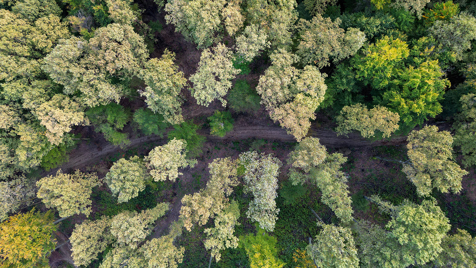
A person lost in dense forest is one of the hardest things to find from the air. The canopy that makes a forest beautiful from above is exactly what defeats a search: leaves and branches scatter light, swallow heat, and break a human shape into a few meaningless pixels. For decades, that single problem has cost search-and-rescue teams precious hours and, too often, lives.
That’s finally starting to change. A handful of technologies that grew up in completely separate worlds, military radar and academic computer graphics among them, have converged on the same stubborn question: how do you reliably spot a human body hidden under trees? The answers arriving now are faster, cheaper, and more accurate than anything available even five years ago, and they’re moving out of the lab and into real rescue operations.
Here’s what’s actually working, what’s hype, and where the field is headed.
A tale of two SARs
There’s a small irony at the center of this field. The acronym “SAR” means two different things here, and both turn out to be central to the story. One is Search and Rescue, the obvious one. The other is Synthetic Aperture Radar, a sensing technique developed for satellites and surveillance aircraft. For most of their histories, these two lived in entirely different communities. The breakthrough of the past few years is that the idea behind synthetic aperture radar has been borrowed and applied to ordinary thermal cameras, and the result is reshaping civilian search and rescue.
To understand why that matters, you first have to understand why the easy approach doesn’t work.
Why a thermal drone alone won’t find you
The intuitive solution is to fly a thermal camera over the forest and look for a warm human body against a cool background. In an open field, that works beautifully. Under a canopy, it falls apart.
The problem is noise, the visual kind. On a sunny day a forest is full of things that look warm to an infrared sensor: sun-baked rocks, patches of bare dirt, thick branches that have soaked up heat all afternoon. A human body sits at roughly 37°C, and so do plenty of those false targets. Worse, the canopy only ever lets a thermal camera glimpse fragments of a person through small gaps in the leaves, so from any single overhead frame a hidden body looks like a few scattered warm specks, indistinguishable from the warm clutter around it.
Feed that to an off-the-shelf object-detection model and it chokes. Models trained on clean, urban thermal footage produce a flood of false positives the moment you point them at a forest floor. In a live rescue, an AI that cries “person!” at every warm rock is worse than useless.
The clever fix: stack the views, erase the canopy
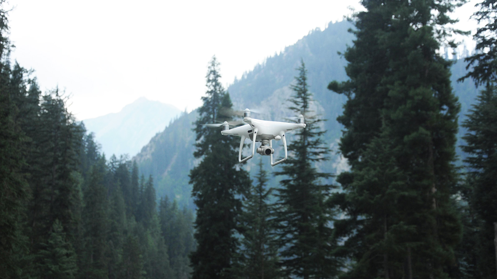
The most elegant answer to this came from an unexpected place: a computer graphics lab. Researchers led by Professor Oliver Bimber at Johannes Kepler University in Austria developed a technique they call Airborne Optical Sectioning (AOS), published in Nature Machine Intelligence in 2020.
The core idea is easiest to grasp with an everyday image. Picture yourself standing right up against a tall picket fence, trying to watch a dog in the yard behind it. Stand still and you catch only disconnected slivers of the dog through the gaps between the boards. But walk quickly along the fence while keeping your eyes fixed on the yard, and something strange happens: the fence seems to dissolve, and the dog comes into clear view. Your brain is fusing dozens of slightly different glimpses into one picture, and the fast-moving foreground simply averages itself away.
AOS does exactly this, but with a drone and a thermal camera. Instead of relying on one overhead shot, the drone captures thousands of thermal images as it moves across a wide area, and software treats that entire flight path as one enormous virtual lens, effectively a camera aperture hundreds of meters across. The system then computationally “focuses” that giant lens on the forest floor. Anything at ground level, like a person, reinforces itself from every angle into a sharp, recognizable shape. Anything above the focal plane, like leaves, branches, and tree crowns, blurs into nothing.
The payoff is twofold. First, the warm clutter in the canopy is literally smeared out of the picture. Second, and just as important, the occlusion problem disappears before the AI ever sees the image. The detection model doesn’t have to be trained on millions of partially hidden bodies in tangled undergrowth; it just reads a clean, processed image as if the person were standing in an open field. In the original work, that approach reached roughly 96% precision and 93% recall at finding people under heavy canopy, a level that simply isn’t achievable with raw thermal frames.
And because AOS doesn’t need exotic hardware, just standard thermal cameras like the FLIR units already used in the field, it’s affordable enough for civilian teams rather than only well-funded militaries.
The other lineage: radar that sees through trees
While the optics crowd was solving the problem with cameras, the defense world had been chipping away at it for half a century with radio waves. Their tool of choice is foliage-penetration (FOPEN) radar, and its history explains a lot about why the problem is so hard.
Ordinary radar uses short, high-frequency waves, the same kind that give you sharp weather and air-traffic images. Those waves bounce off leaves and never reach the ground, which is useless in a forest. So engineers went the other direction, dropping down into the VHF and UHF bands, where wavelengths are long enough to pass through small obstacles like foliage and reflect mainly off large objects like tree trunks, vehicles, and human bodies.
Here’s the catch, and it’s a fundamental one. Think of radar as a sieve dipped into a rushing river. A fine-mesh sieve, like high-frequency radar, catches lots of detail but the water hits it so hard it never reaches the bottom. Swap in a sieve made of wide iron bars, like low-frequency FOPEN radar, and it plunges easily to the riverbed, but the gaps are so big it only catches large rocks and lets everything fine wash through. Long radar waves guarantee penetration, but they sacrifice resolution. You get through the canopy at the cost of a blurry picture.
A series of programs proved this trade-off could be made useful anyway. Sweden’s CARABAS system, conceived and built by the Swedish defense research establishment FOA in the early 1990s (the first radar tests flew in 1992), demonstrated that low-band VHF synthetic aperture radar could pick out concealed targets at a resolution of around 2.5 meters, coarse, but enough to flag a vehicle or a group of people where conventional radar saw only static. Later versions, developed with Ericsson Microwave Systems and eventually Saab, matured and shrank the technology. In the United States, DARPA and the U.S. Army built FORESTER (Foliage Penetration Reconnaissance, Surveillance, Tracking and Engagement Radar), a UHF system designed to track moving people and vehicles under single and double canopy in real time. Flown on a Black Hawk and on the unmanned A160 Hummingbird helicopter, FORESTER could survey on the order of 155 square miles (about 400 km²) from roughly 20,000 feet and detect movement under tree cover from as far as 30 miles away. The A160 itself was a testbed that never reached operational service, the Army ended the program around 2012 after persistent airframe and vibration problems, but the radar technology it carried was successfully proven in the air.
How does it tell a walking person from a tree trunk when both bounce the signal back similarly? Movement. FOPEN radar leans heavily on the tiny Doppler shifts caused by a body in motion, even something as subtle as the rise and fall of a chest, to separate living targets from stationary clutter. Decades of signal-processing work, including the polarization-whitening filters pioneered by radar engineer Mark E. Davis, went into pulling those faint signatures out of the overwhelming forest backscatter.
The cost of all this was enormous. A FORESTER-class system runs into the millions of dollars per unit and needs a helicopter to carry it, which puts it permanently out of reach for a county rescue team. That gap, between what the military can do and what a local search team can afford, is exactly what the AOS approach is now closing.
The missing ingredient: data
For all the progress on sensors, the AI side of the problem was starved of one crucial thing: realistic training data. Almost every public dataset of people seen from drones was shot from high altitude, looking straight down at open ground, the precise scenario where canopy detection fails. Models trained on that data had never “seen” a half-hidden body slumped in the undergrowth, so they performed poorly when it counted.
That’s beginning to be fixed. In early 2026, researchers at Korea’s Electronics and Telecommunications Research Institute (ETRI), working with KAIST, released ForestPersons, presented at the ICLR conference. It’s a large-scale dataset of 96,482 images and over 204,000 labeled instances, built specifically for finding people under forest canopy. Crucially, and in contrast to older datasets, it captures ground-level and low-altitude viewpoints rather than top-down ones. Interestingly, the footage wasn’t shot from flying drones at all: the team used handheld and tripod-mounted cameras held at roughly 1.5 to 2 meters, the expected flight height of a micro aerial vehicle, to emulate that under-canopy perspective without the vibration and gimbal artifacts a real drone would add. Across 377 video sequences spanning different seasons, weather, and times of day, every person is tagged for pose and how badly they’re occluded. The team also published a companion thermal-infrared version. It’s the first benchmark of its kind, and it gives the whole field a common yardstick for training and testing detection models on the conditions that real rescues involve.
What’s coming next
The near-term trajectory points in a few clear directions.
The most striking is drone swarms that behave like flocks of birds. Johannes Kepler University and the German Aerospace Center have been developing groups of drones that don’t fly rigid grid patterns but instead reposition themselves on the fly. When one drone glimpses a possible target through a gap in the leaves, the others shift to surround it and widen that virtual aperture, collaboratively building a sharp image of the spot in real time. Adaptive sampling like this has, in field trials, pushed detection rates dramatically higher than fixed flight paths.
Second is sensor fusion: stop choosing between radar and thermal and run both. Radar can flag something moving behind an impenetrable wall of foliage; the moment that target drifts into a canopy gap, a thermal camera confirms it’s a person. Layering the two cross-checks each other and drives false alarms toward zero.
Third is smarter, on-board processing. Today the heaviest AOS computation often happens back at a ground station. As edge-computing chips get more capable, drones will render those clean, canopy-free images mid-flight, and natural-language search, telling a swarm to look for “a person lying down” rather than configuring detection parameters by hand, is moving from research demo toward field tool.
The honest caveats
None of this is magic, and the marketing around “seeing through anything” deserves some skepticism.
Radar’s biggest weakness is water. Because both human bodies and living vegetation are mostly water, FOPEN radar works by exploiting the subtle electrical differences between them. Heavy rain, morning dew, or high humidity narrows that gap and can effectively blind the system, and wind-tossed wet branches generate exactly the kind of motion the radar is trained to notice, spiking false alarms. There’s also a real safety consideration: the same low frequencies that punch through foliage couple efficiently into the human body, which limits how much power you can responsibly aim at people during civilian operations and is one more reason rescue teams gravitate toward optical and thermal methods.
Thermal-and-optics approaches have their own limits. AOS depends on capturing many overlapping views, which takes flight time and works best when the canopy isn’t completely sealed. And every camera-based method struggles in the densest broadleaf forests, where almost no line of sight to the ground exists from any angle.
There’s also a quieter, more practical constraint that rarely makes the headlines: the whole technique lives or dies on flight precision. To build that giant virtual lens, every thermal frame has to be tagged with an accurate position and orientation so the software can register and stack them correctly. Anyone implementing this on a custom rig, say a Pixhawk-based multicopter flying a tightly controlled MAVLink waypoint grid, runs into the same hard requirement: if the aircraft drifts off its planned path, or the image captures fall out of sync with the telemetry, the integral images won’t line up and the canopy simply won’t disappear. Getting that synchronization right is as much of the engineering challenge as the imaging itself.
The bottom line
For most of modern history, a forest canopy was a near-perfect hiding place from the air. That’s no longer a safe assumption. Between computational thermal imaging that erases the canopy in software, decades of hard-won foliage-penetration radar, and, finally, the realistic datasets needed to train AI for the job, the tools to find a person under the trees are becoming genuinely practical, and cheap enough to reach the teams who need them most.
The remaining challenges are real, but the direction is unmistakable. The question is shifting from whether we can spot someone beneath the canopy to how quickly we can get a swarm of inexpensive drones into the air to do it.
Sources
- Search and Rescue with Airborne Optical Sectioning (Bimber et al., arXiv / Nature Machine Intelligence, 2020)
- Airborne Optical Sectioning (MDPI, peer-reviewed)
- ForestPersons: A Large-Scale Dataset for Under-Canopy Missing Person Detection (ETRI / KAIST, arXiv, ICLR 2026)
- Drone Swarm Mimics Birds and Sees Through the Canopy (Johannes Kepler University, primary)
- Forensic Search from the Air: JKU and DLR Publish Data about real Murder Case (JKU / German Aerospace Center)
- FORESTER radar product page (SRC, Inc., primary)
- 75 Years of Innovation: Foliage-Penetrating Radar Technologies (FOLPEN) (SRI International)
- Performance of the CARABAS-II VHF-band synthetic aperture radar (peer-reviewed)
- An infrared dataset for partially occluded person detection in complex environment for search and rescue (PMC, peer-reviewed)
- Researchers Develop Search and Rescue Technology That Sees Through Forest with Thermal Imaging (Teledyne FLIR OEM)
— Related
Keep reading
Written by
TacLink C2 Team
TacLink C2 Team builds a modern desktop ground control station for independent and commercial drone pilots. Writing here covers mission planning, multi-drone operations, airspace, and the software that keeps serious UAS programs running.