— Field Report
Drone Disaster Response: Hurricanes 2024-2026 Field Report
A field report on two hurricane seasons, four major tropical cyclones, and the global operators, engineers, and researchers who turned uncrewed aerial systems into the new backbone of emergency response.
In early October 2024, as Hurricane Milton underwent one of the fastest periods of explosive intensification ever recorded, meteorologist Josh Wadler was strapped into a Lockheed WP-3D Orion somewhere inside it. The plane was the NOAA “Hurricane Hunter” known as Kermit. Wadler, an Embry-Riddle assistant professor in the Applied Aviation Sciences Department, had a roughly three-pound drone to launch from it. Out of a pneumatic tube in the belly of the aircraft, his team fired a Black Swift S0 into the storm’s eyewall. Minutes later, the drone recorded a sustained wind of 205 knots (235 miles per hour) at 400 meters of altitude. While it was doing that, it was being flung up and down by 40-meter-per-second air currents, the rough equivalent of being whipsawed vertically at 90 mph. Like its fellow drones that season, it transmitted data to the National Hurricane Center in real time before plunging into the sea, with flights running up to 90 minutes.
That measurement, and a lot of others like it, marks a real transition. Between the 2024 Atlantic hurricane season and the catastrophic 2025 Caribbean landfall of Hurricane Melissa, drone disaster response stopped being a novelty item that showed up in dramatic news footage. In many places drones are now the first thing in the air after the wind dies down, and in a few cases during the worst of it. What has actually changed is not just the hardware but the pairing of inexpensive uncrewed aerial systems with AI models that can turn hours of drone footage into actionable damage maps in minutes.
This shift matters because the storms themselves are changing. Rapid intensification, in which a tropical cyclone jumps multiple Saffir-Simpson categories in a single day, is the signature of the modern hurricane season. Milton went from a tropical depression to a Category 5 in under 49 hours, the fastest such transition ever recorded. Hurricane Melissa struck Jamaica on October 28, 2025 with sustained winds of 185 mph at landfall, tying the record for the strongest landfalling Atlantic hurricane. Post-season reanalysis from the National Hurricane Center, released in February 2026, upgraded Melissa’s peak sustained winds to 190 mph, tying Hurricane Allen (1980) for the strongest Atlantic hurricane ever recorded.
Satellites, useful as they are for synoptic views, go blind in the deep convection these storms produce. Crewed aircraft can’t safely descend into the boundary layer where wind-sea interactions drive the storm’s energy. Drones filled that gap, and the two seasons that followed are the best available case study for what drone disaster response looks like when it works, and where it still breaks.
By the Numbers: Drone Disaster Response, 2024-2026
- 235 mph: Peak sustained wind measured by an Embry-Riddle / NOAA drone at 400 m altitude inside Hurricane Milton
- 252 mph: Record wind gust recorded by an NSF NCAR dropsonde in Hurricane Melissa (strongest ever measured by the instrument)
- 190 mph: Melissa’s peak sustained winds per NHC post-season reanalysis, tying Hurricane Allen (1980) as the strongest Atlantic hurricane on record
- 119 minutes: New Guinness World Record for drone endurance inside a tropical cyclone, set by a Black Swift S0 in Hurricane Melissa
- 2,000 homes in 7 minutes: Neighborhood-scale damage assessment speed of Texas A&M’s CLARKE system
- 21,700 buildings: Labeled training set behind the CRASAR-U-DROIDS dataset
- 26+ pilots, ~30 organizations: Coordinated response to Hurricane Melissa, led by Jamaica Flying Labs
- 59,000 people / 1.8 million gallons: Safe water delivered in Jamaica via drone-informed logistics
- 3.51%: Share of Hainan Island’s photovoltaic infrastructure damaged by Super Typhoon Yagi, quantified via UAV remote sensing
The United States: AI-Accelerated Damage Assessment
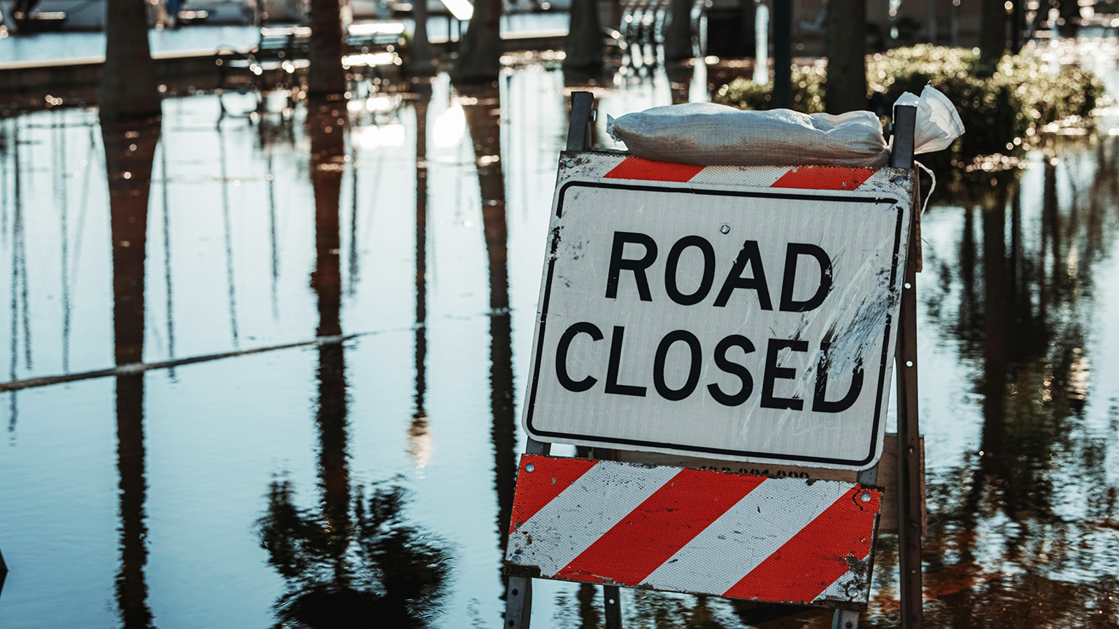
The 2024 hurricane season in the United States was dominated by two names: Helene and Milton. Between them, the storms killed more than 200 people, caused tens of billions of dollars in damage, and served as the proving ground for a generation of AI-accelerated damage assessment tools built on drone imagery.
The core problem is not that drones don’t capture enough data. They capture too much. As Texas A&M researchers put it, a single post-storm flight can produce the equivalent of 66 high-definition feature films’ worth of imagery. Human reviewers cannot possibly process that within the hours that matter most for search and rescue.
CLARKE: A Neighborhood in Seven Minutes
The tool built to solve that bottleneck is called CLARKE (Computer Vision and Learning for Analysis of Roads and Key Edifices). It was developed at Texas A&M by a team led by Dr. Robin Murphy, a pioneer of rescue robotics who led the first small-UAS deployment to Hurricane Katrina in 2005, and Ph.D. candidate Tom Manzini. The name is a nod to Arthur C. Clarke’s observation that any sufficiently advanced technology is indistinguishable from magic, which is apparently what drone pilots working with the system began calling it.
CLARKE’s headline number is striking. According to Murphy, the system can scan an entire neighborhood and assess approximately 2,000 homes in seven minutes. The output is a color-coded damage map (green for intact, yellow for minor damage, red for major damage, purple for destroyed), a spreadsheet listing every structure by address and damage tier, and a routing layer that tells emergency responders which roads are passable.
The training data behind it is the CRASAR-U-DROIDS dataset, one of the largest annotated disaster-imagery collections ever assembled. The team recruited 130 high school volunteers from Texas and Pennsylvania to label damage levels for 21,700 buildings across 16,500 acres of land and 400 miles of roads, drawn from ten major disasters including Hurricanes Harvey, Michael, Ida, Laura, Ian, and Idalia.
CLARKE was operationally deployed during the 2024 season following Hurricane Debby in August and Hurricane Helene in late September. The team was on standby for Milton. The audience that has responded most enthusiastically is not urban emergency management but rural counties, where municipal budgets preclude satellite tasking or crewed flyovers. A $1,500 consumer drone plus CLARKE now produces a damage map more accurate than what a major city might get from legacy techniques. A two-hour training session in Tallahassee organized by Florida State University expected 15 to 20 participants. Nearly 100 registered.
The Limits of Looking Down
A second insight from 2024 came from a separate Texas A&M research group, this one led by Dr. Lei Zou in the Department of Geography. Zou’s team, working with Ph.D. student Yifan Yang, examined imagery captured by Site Tour 360 using Mosaic 360° cameras in the aftermath of Hurricane Milton: 210,469 panoramas at 13.5K resolution, captured roughly one image every meter along every track driven.
What they found complicates the tidy story of aerial AI. Drone assessments systematically underestimated structural damage compared with ground truth. A roof might look intact from above while the home beneath it was compromised beyond repair: blown-out doors, water lines climbing the interior walls, displaced furniture visible through shattered windows. The ground-level view captured a category of damage that is essentially invisible from any altitude. Zou’s group describes their work as “hyperlocal” damage assessment, and the policy takeaway is straightforward. Pre-disaster baseline imagery at the human scale is now a prerequisite for modern AI models to deliver on their promise. You can read more about this work at Mosaic51’s case study.
235 MPH at 400 Meters: Drones Inside Hurricane Milton
Back to Wadler and the drone in Milton’s eyewall. That 235 mph reading was not a fluke. Across the 2024 season, the Embry-Riddle / NOAA team released 19 air-deployed drones, transmitting real-time data back to the National Hurricane Center for up to 90 minutes each. “Those are numbers that you wouldn’t even think were possible to measure,” Wadler told Embry-Riddle’s communications team. The drones were built by Black Swift Technologies and launched in tubes from the belly of the WP-3D Orion. Each one tumbled out, deployed a parachute, unfolded its wings, and dove into the lower boundary layer.
The importance of this data is not just operational. The planetary boundary layer, the bottom few hundred meters of the atmosphere where the storm exchanges heat and momentum with the ocean, is where hurricanes draw their energy. It is also where crewed aircraft cannot safely fly and where conventional dropsondes give only a handful of data points as they fall. Persistent low-altitude sampling by drones is filling a decades-old gap in hurricane physics that directly feeds back into the intensity-forecasting models (like NOAA’s HAFS) that communities use to decide when to evacuate.
The Caribbean: Hurricane Melissa and a Locally Led Response
At 14:00 UTC on October 28, 2025, Hurricane Melissa made landfall near New Hope on the southwestern coast of Jamaica. It was the strongest storm ever recorded to strike the island. Its minimum central pressure of 892 millibars, reached just before landfall, tied the 1935 Labor Day Hurricane for the third-lowest in Atlantic history. As the storm approached, a NOAA Hurricane Hunter dropped a fleet of instruments into it. One of those dropsondes, an NRD41 developed by NSF NCAR, recorded a 252 mph wind gust at an altitude of roughly 200 meters (657 ft), the highest wind ever measured by a dropsonde, eclipsing the 248 mph record set during Typhoon Megi in 2010. NSF NCAR verified the measurement using post-processing software that checks the data against the known physics of hurricanes.
The drone response to Melissa was, by several accounts, the largest internationally coordinated UAS disaster operation ever mounted in the Caribbean. Unlike many past deployments, it wasn’t led from outside. It was coordinated from Kingston by Jamaica Flying Labs and its founder and CEO, Dr. Valrie Grant.
The WeRobotics Social Franchising Model
Jamaica Flying Labs is part of the global Flying Labs network operated by WeRobotics, a nonprofit built on a “social franchising” model: locally owned, locally staffed drone operations that are globally connected for training, equipment, and surge support. The model’s central contention is that disaster response works best when the people flying the drones are the people who live there. Melissa was its stress test.
Jamaica Flying Labs, working with the Office of Disaster Preparedness and Emergency Management (ODPEM), the Jamaica Civil Aviation Authority (JCAA), and the National Emergency Response GIS Team (NERGIST), coordinated a response that mobilized more than 26 professional pilots and roughly 30 partner organizations, including the UN Humanitarian OpenStreetMap Team. The broader Flying Labs network activated across three continents, with local teams in Latin America, Africa, and Asia processing imagery from Jamaican pilots in near-real time so that data collection could continue around the clock. Technology partners including Esri, DroneDeploy, Wingtra, and Skydio contributed software resources or sent teams with equipment.
”Collaboration happens at the speed of trust.”
(Dr. Valrie Grant, CEO, Jamaica Flying Labs)
The operational implication of Grant’s observation is that the partnerships which made the response possible were built years earlier, not in the days after landfall. A second and equally important point came out of the fieldwork. Ground-based pilots were repeatedly approached by residents who redirected them to neighborhoods that hadn’t appeared on official priority lists. That community-sourced layer, integrated with drone imagery and GIS products, gave the response a texture that remote observation alone could not have produced. An in-depth interview with Grant is available on the Pilots of the Caribbean podcast.
Inside the Storm: The Black Swift S0 Breaks a Record
While the coordinated ground response was unfolding, NOAA’s Hurricane Hunters were again inside the storm itself. The Black Swift S0-AD, a 2.75-pound glider with a 54.6-inch wingspan, was launched from the WP-3D Orion “Kermit” into Melissa’s lower boundary layer. It flew for 119 minutes, at one point cruising just 30 feet above the Atlantic as the hurricane barreled forward. That set a new Guinness World Record for the longest endurance inside a tropical cyclone by an uncrewed aircraft, building on the record the S0 had set during the 2024 season. The previous day, another S0 set a companion record for longest communications range from a deployment platform: 191 miles (307 km). That range is a big part of why the aircraft can usefully sample regions where its mothership dare not follow.
Alongside the S0, NOAA deployed Skyfora StreamSondes, ultra-lightweight dropsonde-style instruments that descend more slowly than traditional sondes and can be released in “swarms” of dozens to produce a three-dimensional snapshot of a storm’s structure. The 2024 season was the first year StreamSondes were deployed in significant volume. 91 were released across the season, initially in Hurricane Rafael. The program expanded through 2025.
Drones, Water, and Where Help Goes
The most concrete downstream effect of the aerial mapping was logistical. Drone-derived imagery identified communities cut off by road damage (Ferris Cross, Whitehouse, Savanna la Mar, Darliston, Petersfield, Bluefields in western Jamaica) and fed that information to ground teams deciding where to place water treatment systems.
Water Mission, a nonprofit specializing in emergency safe-water response, deployed its Disaster Assistance Response Team (DART) to Jamaica ahead of the storm. Within two weeks of landfall, two Living Water Treatment Systems were running in Ferris Cross. By the end of February 2026, Water Mission had installed systems in seven locations across the island, producing more than 1.8 million gallons of safe water and serving more than 59,000 people. Operations were then handed off to UNICEF Jamaica and local operators for long-term management. The synergy between drone mapping and logistical resource deployment, aerial data feeding decisions about where to put physical infrastructure, is the clearest operational blueprint to come out of the Caribbean response. (For the domestic-ops version of that cost/benefit case, see our writeup on UAS ROI in emergency response.)
Southeast Asia: Typhoons Gaemi and Yagi
While the Atlantic was producing Helene, Milton, and ultimately Melissa, the western Pacific was running its own accelerated timeline. Typhoon Gaemi (known in the Philippines as Super Typhoon Carina) reached Category 4-equivalent intensity and impacted the northern Philippines, Taiwan, and southeastern China in late July 2024. Gaemi never made direct landfall in the Philippines but enhanced the seasonal monsoon rains catastrophically, with one area of Quezon City receiving 458 mm of rain in 24 hours. The death toll across the region, combining Philippines, Taiwan, and China figures, climbed through early August as rescue and recovery progressed.
The Philippine Air Force readied three Tactical Operations Groups with UAS units to act as aerial spotters for water rescue crews in the flooded Manila metro and Luzon. In mainland China, the Ministry of Emergency Management deployed drones to Hunan Province to monitor dike breaches and landslides, which allowed the MEM to target 4.41 million yuan in relief materials at the locations where they were most needed. The operational pattern matched the Caribbean: drones flew when helicopters could not, and the data they returned directly informed where human responders went next.
Super Typhoon Yagi and the Solar Question
Six weeks later, on September 6, 2024, Super Typhoon Yagi made its first landfall near Wenchang, Hainan, with a minimum central pressure of 921.7 hPa, setting a new record for China. Yagi went on to cause catastrophic damage across Hainan, Guangdong, and Vietnam, eventually killing more than 800 people across eight countries and causing an estimated $14.7 billion in damage.
Yagi is significant for a reason beyond its scale. It was the first time drone-based remote sensing was used systematically to quantify damage to a large-scale solar photovoltaic (PV) deployment. A peer-reviewed study published in the journal Geomatics, Natural Hazards and Risk used positive-unlabelled learning random forest classifiers to compare pre- and post-typhoon PV distribution maps across Hainan, achieving classification accuracy (IoU) exceeding 82%. The findings were sobering: 3.51% of the island’s PV infrastructure sustained direct damage, and more than 5% of PV power plants suffered damage exceeding 35% of installed capacity. Direct damages totaled approximately 253.4 million yuan. Indirect losses reached 301.5 MW in power output and 603.7 million yuan in revenue through early January 2025.
The methodological contribution matters more than the headline numbers. Yagi established that UAV-based multi-sensor assessment, combining RGB orthomosaics with LiDAR point clouds and AI segmentation, is the only viable way to produce rapid damage accounting for renewable energy infrastructure at scale. That evidence is now feeding into Chinese policy on grid resilience and PV siting standards.
The AI Layer: From CNNs to Transformers
Underlying almost all of the operational stories above is an important shift in the underlying AI. From roughly 2017 through 2022, convolutional neural networks (Mask R-CNN in particular) were the gold standard for segmenting buildings and damage in aerial imagery. Between 2023 and 2026 that standard has shifted to transformer-based models, especially Mask2Former.
A 2025 paper in Remote Sensing documented the transition in the Caribbean context, training Mask2Former models on 2,500 samples each of roof decking and roof holes derived from drone RGB orthomosaics captured in Sint Maarten and Dominica. The training used a learning rate of 0.0001 and early-stopping to prevent overfitting. When the training set was expanded to include imagery from the Bahamas and U.S. Virgin Islands, recall on roof-hole detection improved by 29 percentage points, from 52% to 81%. Precision rose from roughly 81% to 86%, and F1-score on roof decking rose from 0.80 to 0.88.
The practical takeaway is that AI damage-assessment performance scales with dataset diversity in a way that is difficult to get around without regional collaboration. A model trained only on Jamaica will generalize imperfectly to Dominica. The research group also found that medium-sized roofs tend to be classified more accurately than very large ones, because large roofs often include complex sub-structures, skylights, and annexes that confuse the model. That nuance matters for insurance adjusters and government agencies relying on automated assessments, particularly in high-density urban corridors.
Drones vs. Satellites: The Resolution Gap
A recurring question throughout the 2024-2026 cycle has been whether high-resolution satellites could substitute for drone-based assessment at scale. They mostly can’t, and it comes down to ground sample distance (GSD).
The best commercial satellites deliver roughly 30-50 cm GSD at the surface. Drones routinely deliver 2-8 cm GSD. That isn’t a marginal difference. It’s the difference between being able to see that a roof exists versus being able to see an individual missing shingle. Satellite imagery is also vulnerable to cloud obscuration, which is exactly what hurricanes produce. Synthetic Aperture Radar (SAR) can penetrate clouds, but it struggles to differentiate standing water from other smooth surfaces in urban environments, a task drone-based RGB and LiDAR handle with relative ease. Comparative studies across the 2024-2026 period show that random-forest classifiers applied to drone imagery achieve accuracy in the mid-90s, while satellite-only equivalents hover in the mid-to-high 70s.
This doesn’t make satellites obsolete. They remain the right tool for synoptic, pre-landfall, and regional-scale work. But for the hyperlocal, post-landfall damage assessment that drives actual resource allocation, drones are now the operational standard.
Regulatory and Technical Barriers
The operational story over two seasons has been one of remarkable progress. The policy story has lagged.
In the United States, the FAA’s Part 107 rules provide a reasonably structured legal framework for commercial drone operations, and 333 exemptions enable broader flights. Beyond Visual Line of Sight (BVLOS) operations, the kind most useful for large-area damage assessment, remain substantially restricted. The American Red Cross and other humanitarian organizations have publicly noted that regulatory uncertainty around commercial drone use during active emergencies remains a barrier to scaling what is otherwise proven technology. (For a deeper read on where Part 107 stands today, see our FAA compliance guide for UAS software in 2026.)
In the Caribbean, the challenge is different. During the Melissa response, pilots certified in one island nation were not legally authorized to operate in neighboring jurisdictions without re-certifying locally, a delay that, as Grant has pointed out in multiple forums, can be fatal in an active emergency. What the region needs is not more structure but harmonized reciprocal certification frameworks for humanitarian UAS operations.
The technical barriers are more mundane but no less constraining. Three recur across every operation. Cellular networks failed catastrophically in the hours after both Milton and Melissa, leaving drone teams dependent on portable satellite links (Starlink in particular) to upload imagery to AI systems like CLARKE. Power management is its own persistent logistical problem: keeping batteries charged in the field without grid power, as the Jamaica Flying Labs team encountered, amounts to running “a new airline industry” of ground and in-air logistics from scratch. And payload and environmental limits still ground most consumer drones in winds above 30-40 mph, even as specialized platforms like the Black Swift S0 survive Category 5 conditions. Closing that gap, meaning affordable platforms that can fly in gale-force conditions, is an active area of research, including work on the University of Oklahoma’s “CopterSonde” for atmospheric profiling in severe weather. (For how public safety programs handle the ordinary-weather version of the same problem, see our writeup on drone operations in adverse weather.)
Who Coordinates What
Coordination turned out to matter as much as technology. Three organizational patterns are worth highlighting.
The NOAA Uncrewed Systems Operations Center (UxSOC) has shifted toward what it describes as enterprise-level coordination, integrating the Black Swift drone program with surface assets like Saildrone uncrewed sailing vessels and Argo ocean floats to sample the entire air-sea column during storms. The goal is operational, not experimental. During the 2025 season, NOAA used this multi-platform approach in Hurricanes Erin, Humberto, and Melissa.
The American Red Cross has partnered with Amazon’s disaster response team, leveraging Amazon’s pre-positioned Disaster Relief Hubs and drone capability. In the aftermath of Hurricane Helene, Amazon’s team used drone mapping to assess devastation across remote areas of Tennessee and Florida, producing imagery that supported search-and-rescue missions.
Jamaica Flying Labs continues to emphasize that drone-response capacity is, fundamentally, a workforce question. The organization invests heavily in youth STEM education and GIS training specifically so that when international aid organizations rotate out, local expertise remains. That’s the social-franchising model’s central claim, and after Melissa it has working evidence behind it. (The same workforce-first logic underpins how domestic programs get built. See our 7-phase SAR drone program setup for the stateside analog.)
What the Two Seasons Taught Us
A few durable lessons have come out of the 2024-2026 cycle.
The most important is that AI is no longer optional in modern disaster response. Without systems like CLARKE, the sheer volume of drone-captured data becomes an operational liability rather than an asset. Future funding should prioritize open-source AI models and annotation datasets so that rural counties and small island nations can access rapid damage assessment on the same terms as large urban jurisdictions.
Just as important, pre-disaster baseline imagery is now a precondition for the assessment that follows. Deep-learning damage models only work when they can compare post-storm imagery against a “ground truth,” preferably both aerial and street-level, and ideally at the 360-degree, human-scale resolution that Zou’s team used with Mosaic data. Public policy should mandate regular capture of this baseline imagery in vulnerable regions. The cost is modest. The payoff during a storm is enormous.
The less obvious point is how much local knowledge still enhances digital data. Jamaica’s response to Melissa showed that community engagement (pilots being redirected by residents to unlisted priority areas) is the missing variable in geospatial intelligence. Drones are as much a tool for conversation as they are for observation.
On the policy side, regulatory harmonization is overdue. Cross-border UAS deployment is now a humanitarian use case in its own right. The lack of reciprocal certification frameworks in regions like the Caribbean is a structural drag on response speed. Bilateral agreements or a standing regional framework would directly save lives. And on the technical side, multi-sensor integration has moved from best-practice to requirement. Assessing a PV plant, a distribution network, or a port requires more than RGB imagery from overhead. LiDAR, thermal, and AI-driven segmentation together, the combination proved out during Yagi, is the new baseline.
The drones that flew into Milton at 400 meters, the ones that mapped western Jamaica after Melissa, the ones that produced damage maps of rural Pennsylvania after Helene: they’re not the technology of the future anymore. They’re what’s in the air now, and the hurricane seasons to come will be measured, at least in part, by how well the human and regulatory systems around them keep up.
Frequently Asked Questions
What is CLARKE AI? CLARKE (Computer Vision and Learning for Analysis of Roads and Key Edifices) is an AI system developed at Texas A&M that analyzes drone imagery to rapidly assess disaster damage. It can classify approximately 2,000 homes in seven minutes and produces color-coded damage maps alongside routing data for emergency responders.
How fast can drones assess hurricane damage? Modern AI-assisted drone workflows can assess a neighborhood of 2,000 homes in roughly seven minutes, compared with several days for traditional manual assessment or satellite tasking. Overall accuracy for drone-based random-forest classifiers sits in the mid-90% range, versus mid-to-high 70% for satellite-only methods.
What is BVLOS and why does it matter for disaster response? BVLOS stands for Beyond Visual Line of Sight. It’s the class of drone operation in which the pilot cannot directly see the aircraft. BVLOS is the most useful mode for large-area damage assessment after a disaster because a single pilot can cover miles of affected terrain, but it remains heavily restricted under FAA Part 107 rules in the United States.
What drone set the record for flight inside a hurricane? The Black Swift S0-AD, a 2.75-pound glider with a 54.6-inch wingspan, flew for 119 minutes inside Hurricane Melissa in October 2025, a Guinness World Record for the longest endurance inside a tropical cyclone by an uncrewed aircraft.
Who coordinated the drone response to Hurricane Melissa in Jamaica? Jamaica Flying Labs, led by Dr. Valrie Grant, coordinated the response in partnership with ODPEM, the Jamaica Civil Aviation Authority, NERGIST, and the global WeRobotics / Flying Labs network. The operation mobilized more than 26 professional pilots and roughly 30 partner organizations.
Further Reading & Primary Sources
- National Hurricane Center: Tropical Cyclone Report, Hurricane Melissa (AL132025)
- Texas A&M on CLARKE: AI turns drone footage into disaster response maps in minutes
- Embry-Riddle: Braving the Storm, Flying Into Hurricane Milton
- Jamaica Flying Labs: A Locally Led, Globally Supported Drone Response to Hurricane Melissa
- NOAA AOML: Innovations in Research, 2025 Atlantic Hurricane Season
- Guinness World Records: Longest endurance inside a tropical cyclone by an uncrewed aircraft
- NSF NCAR: Record-breaking winds confirmed for Hurricane Melissa
- Mosaic51: How Texas A&M Is Pioneering Damage Assessment Using Mosaic Imagery
- Remote Sensing (MDPI): Automated Mapping of Post-Storm Roof Damage Using Deep Learning
- Geomatics, Natural Hazards and Risk: Quantitative assessment of typhoon-induced photovoltaic damage, Typhoon Yagi 2024
- Water Mission: Bringing Safe Water to Hurricane Melissa Survivors
— Related
Keep reading
Written by
TacLink C2 Team
TacLink C2 Team builds a modern desktop ground control station for independent and commercial drone pilots. Writing here covers mission planning, multi-drone operations, airspace, and the software that keeps serious UAS programs running.