— Article
Multi-Domain Sensor Fusion: Radar, RF, Cameras, AI
A single radar can tell you something is out there. A camera can tell you what it looks like. A radio-frequency sensor can tell you who’s flying it. None of them, on their own, can tell you the whole story, and in a world filling up with cheap drones, blurred borders, and threats that move at machine speed, half a story is often worse than none at all.
That gap is the entire reason multi-domain sensor fusion exists. It’s the technology that takes a dozen different sensors, each with its own blind spots, and stitches them into one coherent picture an operator can actually act on. If you’ve followed the rise of companies like Anduril or Palantir, or watched footage of “drone walls” going up along contested borders, you’ve already seen sensor fusion at work, even if nobody called it that.
This guide breaks down what sensor fusion really is, where it came from, how it works under the hood, and why it’s quietly become one of the most important, and most contested, technologies in modern defense and security. (If you’re interested in the navigation side of fusion, where the same math keeps a single drone flying when its satellite signal drops out, see our companion piece on drone sensor fusion and GPS-denied navigation.)
What Multi-Domain Sensor Fusion Actually Means
Strip away the jargon and the idea is simple. Sensor fusion is the process of combining data from several different types of sensors so the combined result is more accurate, more reliable, and more useful than any single feed could be on its own.
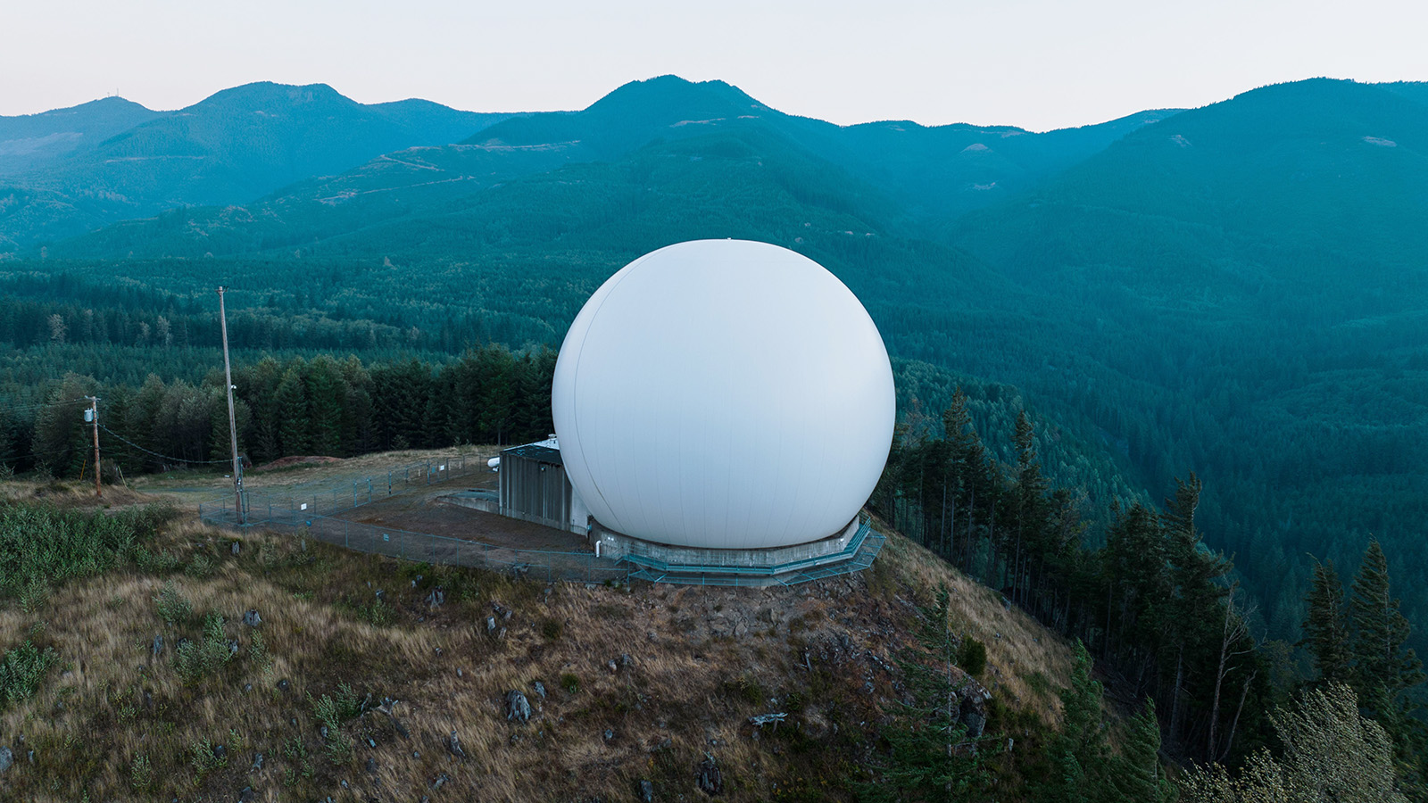
In a defense or border-security context, those sensors usually fall into a few buckets: radar, which sweeps wide areas and tracks movement; electro-optical and infrared (EO/IR) cameras, which provide the visual and thermal confirmation; radio-frequency detectors, which listen for the signals passing between a drone and its pilot; and unattended ground sensors that pick up vibration, sound, or magnetic signatures close to the earth. Some systems add LiDAR (Light Detection and Ranging) for 3D mapping on top.
The “multi-domain” part matters. Older systems fused data within one domain (a couple of radars talking to each other, say). Modern fusion reaches across air, ground, sea, space, and cyber, pulling a satellite image and a ground sensor and a fighter jet’s onboard radar into the same operating picture. The goal is what the military calls a Common Operating Picture (COP): a shared operational view that cuts down on conflicting information and gives everyone the same baseline understanding of what’s happening, instead of a wall of monitors that a human has to cross-reference in real time. It doesn’t erase uncertainty (different units may still weigh the same track differently) but it gives them a common starting point.
Here’s the part that makes it powerful. Every sensor has a weakness. Radar is great at spotting movement at range but bad at telling a small drone apart from a large bird. Cameras give you certainty about what you’re looking at, right up until fog or darkness rolls in. RF sensors can often identify a commercial drone by its control link and, in many cases, geolocate both the aircraft and its operator, but they go deaf the moment a drone flies autonomously with its radio switched off. Fusion works because the weaknesses don’t overlap. Where one sensor goes blind, another is still watching. Layer enough of them together and the system becomes genuinely hard to fool.
From the Ho Chi Minh Trail to the Tactical Edge: A Short History
People treat sensor fusion like it arrived with the AI boom. It didn’t. The first serious attempt is almost sixty years old, and the story of how it got from there to here explains a lot about why today’s systems are built the way they are.
Operation Igloo White and the original “automated battlefield”
During the Vietnam War, the U.S. faced a problem it couldn’t solve with troops: the Ho Chi Minh Trail, a sprawling supply network winding through Laos that fed the North Vietnamese war effort. Sending soldiers into neutral Laos wasn’t an option, so under the classified program Operation Igloo White, the military tried something radical for the late 1960s. It seeded the jungle with thousands of air-dropped sensors.
There were acoustic units like the Acoubuoy, designed to float down by parachute and snag in the trees so they could listen for truck engines and voices, and seismic detectors like the ADSID, essentially an electronic lawn dart that buried itself in the ground with only a weed-shaped antenna showing. The sensors relayed their signals to orbiting aircraft, which passed the data to IBM computers at a base in Thailand, where analysts tried to turn the noise into bombing targets.
It was visionary. It was also a mess. The system had no real way to filter what it was hearing, and North Vietnamese forces figured that out fast, according to multiple historical accounts, hanging sensors in trees to confuse them and triggering the chemical “people sniffers” with buckets of urine. False alarms piled up, and airstrikes got called on phantom convoys. Igloo White never stopped the infiltration. But it proved a concept that has driven the field ever since: remote, multi-sensor data could be aggregated and used to direct action.
The slow road to actually making it work
The decades after Vietnam were mostly about fixing Igloo White’s core flaw, the inability to tell signal from noise. In the 1990s, Sandia National Laboratories used the isolation of the Nevada Test Site to rigorously characterize seismic and acoustic sensors, teaching algorithms to distinguish a footstep from a passing truck from background geological rumble.
The 2000s brought the technology to the civilian world. The Department of Homeland Security’s SBInet “virtual fence,” built around the Project 28 proof-of-concept, tried to network ground radar, cameras, and ground sensors along a stretch of the Arizona border. It was an early swing at “slew-to-cue” (radar spots something, camera automatically swings to look at it). And it stumbled on the same rock Igloo White did: wildlife, weather, and brush set off endless false alerts because the filters couldn’t learn.
Edge computing changes everything
The breakthrough wasn’t a new sensor. It was where the thinking happened. Disruptive defense firms (Anduril is the most visible) recognized that hauling raw video back to a central server introduced real latency, ate bandwidth nobody had, and didn’t scale. So they moved the brain to the sensor. Solar-powered “Sentry Towers” packed radar, cameras, and an onboard compute module onto a single mast. Instead of streaming raw footage, the tower’s computer vision classified what it saw (human, vehicle, animal) and sent only a tiny metadata alert. The alert fatigue that had doomed every previous generation finally had an answer. The same architecture choice (do the heavy lifting at the sensor, not in a far-off data center) is the central thesis of our piece on edge vs cloud AI for drones.
By 2020, the U.S. Army was demonstrating where all of this leads. During its Project Convergence exercise at Yuma Proving Ground, the Army ran a kill chain that started with satellite imagery, fed it through an AI system called Prometheus to generate targeting data, passed that to a Marine Corps F-35B over the Link 16 datalink, and used an AI tool called FIRESTORM to match the threat to the best available shooter on the ground. The headline result: the sensor-to-shooter timeline collapsed from roughly 20 minutes to about 20 seconds. That number gets quoted constantly, and for once the hype is earned: it’s a real, documented order-of-magnitude jump.
How Sensor Fusion Works Under the Hood
The hardware is the easy part. The genuinely hard problem is that every sensor speaks a different language, different data formats, different refresh rates, different levels of confidence in what it’s reporting. Fusing them is mostly a software and mathematics challenge. A few pieces are worth understanding.
Lining up time and space. Before any data can be combined, it has to be aligned. A radar might update ten times a second while a camera runs at thirty frames a second, so the system timestamps every incoming packet down to the microsecond and maps every detection into a single shared 3D coordinate space. On a moving platform (a counter-drone system mounted on a truck, for instance) it also has to constantly correct for its own motion using GPS and inertial sensors. If the precision timing slips, even slightly, the whole thing falls apart and one target starts showing up as two “ghost” tracks.
Slew-to-cue and feature stacking. The most visible behavior is still slew-to-cue: radar catches a moving anomaly at long range, the software calculates its trajectory, and a camera automatically pans and zooms to lay eyes on it. Newer neural-network approaches go further. Rather than letting each sensor make an independent call, they merge the raw feature data from thermal, visual, and radar into a single combined input, so one model can weigh an object’s heat signature, shape, and radar behavior all at once. Evaluating them together rather than separately is what pushes classification accuracy up and false alarms down. We covered the visual side of that work in reducing false positives in drone YOLO detection.
Predicting where things are going. To track a moving target, fusion systems lean on a family of tools called Kalman filters, which continuously estimate a target’s full state (typically its position, velocity, and the uncertainty around both) and then refine that estimate the instant a fresh measurement lands. There’s a famous trap here. When several platforms (say, a swarm of drones) share what they’re each seeing about the same target, their data starts to overlap, and a naive filter will double-count that shared information and become wildly overconfident. Advanced systems use a technique called Inverse Covariance Intersection to keep the math honest. Think of it as a safeguard against counting the same piece of evidence twice when multiple sensors are indirectly watching the same target. It bounds the error so the fused estimate stays trustworthy without becoming needlessly pessimistic.
Anchoring probability to certainty. One clever trick in the counter-drone world deserves a mention. Radar gives you a probability (“80% chance this is a drone”) which always carries some risk of crying wolf. RF detection, by contrast, can be far more definitive: if a sensor detects and decodes a known commercial drone’s control protocol, confidence in that identification can be extremely high. Fusion engines pin the fuzzy radar track to that much harder RF read, blending continuous flight-path data from the radar with near-certain identification from the RF. The operator stops guessing.
The Numbers Behind the Boom
You don’t get this much engineering effort without serious money chasing it, and the market figures make the trajectory obvious.
The clearest signal is in counter-drone systems specifically. One widely cited forecast from Precedence Research puts the global counter-UAS market at roughly $2.08 billion in 2025, growing to around $19.06 billion by 2035, a compound annual growth rate near 26%. Forecasts vary significantly between analysts depending on methodology and how they define the category, but they broadly agree on the trajectory: steep, sustained, double-digit growth driven by the simple fact that weaponized commercial drones have become a frontline reality.
Radar remains the bedrock layer underneath all of it. The global military radar market sat at roughly $16.9 billion in 2024 by IMARC Group’s estimate, with ground-based systems holding the largest slice. What’s changed is the mission. A growing share of new radar development is now aimed squarely at detecting small, low, slow drones rather than fighter jets and missiles.
On the performance side, the case for fusion is increasingly empirical rather than theoretical. Academic work over the past couple of years has shown that combining modalities (for example, thermal plus optical plus radar) measurably outperforms any single sensor at detecting drones against messy backgrounds, with reported accuracy climbing into the mid-90s. Lightweight AI models running on edge hardware are hitting similar marks separating drones from birds and clouds. The recurring theme across the research: every honest sensor layer you add tends to push accuracy up and false alarms down.
That last point is where the money really comes from. Reducing false alarms isn’t a nice-to-have. It’s the difference between operators who trust the system and operators who tune it out, the exact failure that sank Igloo White and SBInet.
Who’s Building the Future of Sensor Fusion
The market splits roughly into two camps: software-first disruptors who came up through Silicon Valley, and the hardware specialists and traditional primes who build the sensors themselves.
On the disruptor side, Anduril has reshaped how this category gets sold. Its core product is Lattice, an open software platform that acts as the command-and-control brain, ingesting feeds from its own hardware (the autonomous Sentry Tower, the Ghost surveillance drone, interceptors like Anvil and Roadrunner) and fusing them into a single 3D picture. Founder Palmer Luckey has been openly evangelical about handing the “dull, dirty, and dangerous” work of monitoring sensors to AI while keeping humans in charge of the consequential decisions.
Palantir operates a level up, at the theater and strategic scale, where its Maven Smart System (MSS), which grew out of work supporting the Pentagon’s original Project Maven initiative, fuses satellite imagery, drone feeds, and ground sensors across whole commands. In December 2024, Palantir and Anduril announced a consortium explicitly linking Palantir’s enterprise-scale data fusion with Anduril’s tactical-edge autonomy, an attempt to build a continuous pipeline from space all the way down to the soldier on the ground.
D-Fend Solutions specializes in the RF and cyber side of counter-drone work, with systems that can identify and even take control of rogue drones, then automatically reconcile those certain RF identifications with probabilistic radar tracks.
Among the hardware specialists, Echodyne pioneered compact electronically-scanning radar small and efficient enough to ride on an autonomous tower or mobile unit, supplying the early-warning data that tells the cameras where to look. Teledyne FLIR Defense brings decades of thermal and optical imaging expertise into integrated mast-mounted systems that fuse radar, EO/IR, and RF for perimeter and force protection. And General Atomics is pushing fusion into the air itself, loading intelligence and radar payloads onto Gray Eagle drones so they can cross-cue data and team with crewed aircraft.
Behind all of them sit the government architects, the Department of Defense and DARPA (the Defense Advanced Research Projects Agency), whose push for open, interoperable command-and-control standards is forcing the whole industry toward systems that can actually talk to each other, and labs like Sandia that still do the unglamorous work of making ground sensors reliable in the real world.
The Hard Problems Nobody Has Fully Solved
It would be a mistake to present any of this as finished. Sensor fusion runs into stubborn technical limits and genuinely difficult ethical questions, and pretending otherwise does the technology a disservice.
The false-positive problem never fully dies
In a cluttered urban or coastal environment, a radar can throw off enormous numbers of potential targets, and RF sensors have to work in spectrum saturated by consumer Wi-Fi and Bluetooth. When the filtering algorithms get it wrong, the system starts flagging birds, swaying trees, and passing cars as threats. The moment operators stop trusting the alerts, the entire investment is worthless. Modern systems are dramatically better than their ancestors at this, but “dramatically better” isn’t “solved.” The same trust-erosion failure mode is exactly what real teams rehearse against in counter-drone tabletop exercises.
Physics doesn’t care about your software
Running heavy neural networks and tracking filters takes power and generates heat, and mobile platforms are tightly constrained on size, weight, and power. They also get shaken, baked, and frozen. Those stresses degrade the precision oscillators that keep the system’s timing aligned, and once timing drifts, the fusion engine can no longer reliably match a radar coordinate to a camera frame, and the hallucinated double-targets return.
Dark drones and contested spectrum
The cleverest adversaries don’t fight the sensors; they avoid them. In a heavily jammed, GPS-denied environment, the RF layer of a fusion system can simply be switched off by circumstance. And a growing class of autonomous “dark” drones navigates by inertial sensing and onboard vision while emitting no radio signal at all, which also makes them impervious to standard RF jamming, since there’s no control link to disrupt. Against those, the system loses its easiest, most certain source of identification and has to fall back entirely on radar, acoustics, and optics, a much harder detection problem.
The ethics are real, and reasonable people disagree
The most serious debate isn’t technical. As fused sensor data flows directly into interceptors and effectors, critics warn that the kill chain is being compressed to the point where meaningful human control could erode, and that trusting computer vision to distinguish a combatant from a civilian risks catastrophic mistakes encoded in algorithmic bias.
Industry figures push back hard. Luckey’s go-to argument is blunt: there’s no moral high ground, he contends, in fielding a dumb weapon like a landmine that can’t tell a school bus from an armored column. Better sensors and better fusion, in this view, increase precision and reduce indiscriminate harm by ensuring force is applied only to verified threats. Critics aren’t fully satisfied by that, though. They point out that better precision doesn’t on its own answer the harder question of who is accountable when an autonomous or AI-assisted targeting decision goes wrong.
There’s a parallel worry on the civilian side. Networks of towers that can persistently track every person, vehicle, and phone across miles of terrain are, functionally, mass-surveillance infrastructure, raising real constitutional questions about how that data is stored and used. Defenders point out that some fusion layers are inherently privacy-preserving (radar that reports only speed, direction, and rough object class captures no faces and no identities). Both things can be true at once, which is exactly what makes the debate hard.
Where Sensor Fusion Goes Next
A few trends are worth watching over the next handful of years.
Passive sensing using cellular networks. Traditional air-defense radar broadcasts loudly and gets targeted for it. Researchers are working on systems that piggyback on existing 5G and 6G signals, analyzing how those everyday transmissions bounce off flying objects to create a passive radar web that detects low-flying drones without emitting any dedicated military signal of its own.
Swarms that are their own computer. Instead of remote sensors feeding a central command post, the swarm itself becomes the processor: drones sharing raw data mid-flight, collectively mapping their environment and dividing up tasks, all from a single high-level human instruction rather than moment-to-moment control. The decentralized-tracking math discussed earlier is precisely what makes this feasible.
Underground and industrial fusion. The same techniques are moving into GPS-denied, zero-visibility spaces. Mining and subterranean operations are deploying drones that fuse LiDAR, multispectral imaging, and acoustic probing to map tunnels and spot structural weaknesses before any human has to go in.
The far edge. At the research frontier, teams are exploring exotic inputs to feed into fusion engines: gravitational mapping that could reveal deep bunkers invisible to radar, quantum-enhanced receivers for picking up the faintest emissions, even bio-hybrid sensors that aim for something like a dog’s sense of smell for chemical threats. Most of this is years out. Some of it won’t pan out. But the direction is clear.
The Bottom Line
For sixty years, the dream behind sensor fusion has been the same: see everything, get fooled by nothing, and let humans focus on judgment instead of staring at monitors. What’s different now is that the supporting pieces (cheap compute at the edge, AI that can actually classify what it sees, and the mathematics to fuse noisy inputs without losing the plot) have finally caught up to the ambition.
The result is a field moving fast in both capability and money, and one that carries unresolved questions about autonomy, privacy, and control that deserve to be taken seriously rather than waved away. Whether you’re evaluating these systems, building them, or just trying to understand the technology reshaping modern security, the core insight is worth holding onto: the power was never in any single sensor. It’s in teaching them all to think together.
— Related
Keep reading
Written by
TacLink C2 Team
TacLink C2 Team builds a modern desktop ground control station for independent and commercial drone pilots. Writing here covers mission planning, multi-drone operations, airspace, and the software that keeps serious UAS programs running.