— Field Report
Starlink Drones: How Satellite Links Unlock BVLOS Flight
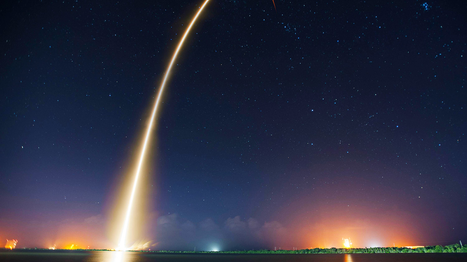
For most of the short history of commercial drones, the single biggest constraint on what an uncrewed aircraft could do was not its battery, its camera, or its motors. It was the invisible leash connecting it to a human on the ground. A radio link can only reach so far before the horizon, a mountain ridge, or a city block swallows the signal. Cellular networks extend that reach, but they were engineered for phones at street level, not aircraft moving through the sky. The result was a hard ceiling on ambition: a drone could only go where its operator could maintain a connection, which usually meant where the operator could practically see it.
That ceiling is now being lifted by an unlikely component: a flat, pizza-box-sized satellite dish bolted to the top of the airframe. The integration of SpaceX’s Starlink low-Earth-orbit (LEO) network into uncrewed aerial systems has, over the span of roughly two years, moved from battlefield improvisation to shipping commercial product. In March 2026, a Seattle company put the change on a spec sheet anyone could buy. The implications stretch from police rooftops to remote power lines to the contested waters of the Black Sea, and they raise questions about who, exactly, controls the skies when the connection runs through a single private company’s satellites.
Why line of sight was the wall
To understand why satellite connectivity matters so much, it helps to understand how badly the old options failed at scale.
Early commercial and tactical drones relied on direct radio-frequency (RF) links between a ground controller and the aircraft. The arrangement is simple and low-latency, but it demands an unbroken line of sight. Fly behind a hill or beyond the visible horizon and the link drops, triggering an automatic return-to-home abort. The leash, in other words, was real.
The industry’s first workaround was to piggyback on commercial cellular networks: 4G LTE and later 5G. This made early beyond-visual-line-of-sight (BVLOS) testing possible at FAA-sanctioned sites, but it inherited cellular’s blind spots. Towers are aimed downward at ground users, not upward at aircraft; drones at altitude run into interference, fumbled handoffs between towers, and outright dead zones over rural, mountainous, or maritime terrain. Cellular extended the leash but never cut it.
Traditional satellite communications could in theory provide global coverage, but legacy geostationary and older LEO systems came with crippling trade-offs: latency measured in half-seconds or more, bandwidth often capped at a fraction of a megabit, and terminals heavy enough that only large military-grade aircraft could carry them. According to industry analysis, legacy aviation SATCOM terminals could cost into the hundreds of thousands of dollars and deliver uplink speeds as low as 0.4 Mbps, enough for basic telemetry, useless for streaming high-definition video. SATCOM solved the coverage problem and created an affordability-and-weight problem in its place.
Starlink’s constellation of thousands of low-orbit satellites changed the math on coverage and latency. But the commercial drone sector still couldn’t use it until the hardware shrank.
The terminal that changed everything
The pivotal hardware moment came in mid-2024 with the Starlink Mini, a compact terminal that collapsed the size, weight, and power (SWaP) penalty that had kept satellite dishes off small aircraft. Where earlier standard and enterprise Starlink dishes drew somewhere between 75 and 150 watts, the Mini operates in the range of roughly 20 to 40 watts and can run off a standard 100-watt USB Power Delivery source. That efficiency is what made satellite C2 viable for “Group II” drones, those under the 55-pound threshold that defines the bulk of commercial and public-safety aircraft under FAA Part 107.
The terminal itself uses a flat, electronically steered phased-array antenna. Instead of a motorized gimbal physically swiveling to track satellites racing across the sky at orbital velocity, the Mini steers its radio beams electronically, with no moving parts to fail. That makes it both lighter and more rugged, well-suited to an airframe that vibrates, banks hard, and lands repeatedly.
Even at 20 to 40 watts, the terminal is not free. A continuous 40-watt draw consumes roughly 40 watt-hours over an hour-long flight; on a drone carrying a 500-watt-hour battery pack, that is about a tenth of the energy budget spent purely on staying connected. Every integrator therefore makes a direct trade among endurance, payload, and connectivity. As one camp of engineers frames it, that is a trade worth making: a drone that sacrifices some flight time but can actually finish its mission beats a more efficient drone that aborts the moment it loses signal.
Proven under fire
The case that LEO satellite links could reliably steer a fast-moving uncrewed vehicle through hostile conditions was made, dramatically, in Ukraine. Ukrainian forces mounted Starlink terminals on improvised naval kamikaze surface drones, piloting the vessels by high-definition video link across the Black Sea, through heavy electronic-warfare jamming, to strike Russian ships. Operating at high speed over long distances, those uncrewed boats demonstrated a level of command-and-control resilience that no one had previously associated with consumer satellite internet. The lesson transferred directly to aircraft: if a commercial LEO link could control a 50-mph attack boat in a jammed combat zone, it could certainly fly a survey drone over a mountain range.
The same conflict also previewed the technology’s central controversy, which we’ll return to: the operator of those Starlink terminals was a private company that retained the power to alter coverage at its discretion.
From lab to airframe
The commercial validation came through aviation connectivity specialists. In a milestone widely cited in the industry, uAvionix announced successful test flights pairing Starlink with its muLTElink airborne radio, reporting data rates in the megabits per second with latencies consistently below 100 milliseconds. (The briefing material circulating on this topic dates that test to early 2023; the uAvionix announcement actually appeared in 2024, and the company’s multi-link Starlink work has continued through 2025, including a notable multi-datalink BVLOS demonstration in Wales.) The significance was that a LEO link could carry both real-time control commands and high-bandwidth payload data at latencies low enough that a remote pilot wouldn’t feel the lag.
That sub-100-millisecond figure is the crux of the whole enterprise. Manual piloting becomes dangerous once round-trip latency climbs past roughly a quarter-second; geostationary SATCOM, at 500 to 1,000 milliseconds, was always unusable for hands-on control. Starlink’s optimized round trips, frequently reported in the 20-to-100-millisecond band, make satellite piloting feel, to the operator, essentially indistinguishable from a local radio link.
By August 2024, manufacturers were integrating the Mini into real airframes. Ohio-based Event 38 Unmanned Systems announced it was adding the Starlink Mini to its E455, a fixed-wing vertical-takeoff-and-landing (VTOL) mapping drone built for long-endurance missions over infrastructure-poor terrain. The E455 sits just under the 55-pound Part 107 limit, and where waivers permit, Event 38 says it can take off at up to about 60 pounds gross weight, carrying roughly 12 pounds of useful payload. It hauls mapping, LiDAR, and EO/IR sensors and offers roughly two hours of endurance on battery power, longer in its gas or hydrogen-fuel-cell configurations. For pipeline, agricultural, and survey work spanning hundreds of square miles, persistent connectivity over that range is the entire point.
The Guardian moment
If Event 38 represented the technology arriving for industrial mapping, BRINC’s Guardian represented it arriving for public safety as a turnkey product. On March 24, 2026, the Seattle company unveiled the Guardian, billing it as the world’s first Starlink-connected drone built for 911 response, and announced a new manufacturing facility that more than doubled its production footprint.
The specifications tell the story of what satellite connectivity unlocks. The Guardian can reach incidents up to eight miles from its base, more than double the roughly three-mile ceiling of competing non-DJI “Drone as First Responder” platforms, a limit imposed largely by connectivity rather than battery. It flies for up to 62 minutes at a top speed north of 60 mph, quick enough to actually cover that eight-mile radius while the call is still active, carries an IP55 weather rating, and packs dual HD thermal zoom cameras, a 1,000-lumen spotlight, a laser rangefinder, and a siren the company says is three times louder than a police cruiser’s.
The connectivity architecture, which BRINC calls Connect 2.0, is the real structural change. It stacks three independent links, Starlink satellite, dual-SIM 5G/LTE, and a local mesh radio, so that if any one channel fails, the other two are already live. This is the same redundancy philosophy that aviation regulators demand, productized into a single airframe. As founder and CEO Blake Resnick put it, drone-as-first-responder operations had been limited by camera capabilities, connectivity, and contact charging, and the Guardian was built to attack all three. “This is the drone I’ve wanted to build for a decade,” he said.
The drone is only half the system. Paired with the robotic Guardian Station, the aircraft launches, lands, and re-arms with no human on site. Older “drone in a box” nests forced the aircraft to sit on contact chargers for 25 to 45 minutes between flights, dead time that crippled true round-the-clock readiness. The Guardian Station instead uses a robotic mechanism to swap a depleted battery for a charged one in under 40 seconds, and can load mission-specific payloads autonomously. Triggered directly from a Motorola APX NEXT radio or a 911 dispatch system, the nest opens and the drone is airborne toward the coordinates without anyone touching it. One technology outlet captured the ambition in its headline, framing the Guardian as a system that could “replace the police helicopter.”
How the link actually works
Strip away the marketing and the mechanics are an exercise in IP networking layered onto an aircraft. Onboard, a flight controller, commonly a Pixhawk-class unit running PX4, handles stabilization, motor mixing, and immediate safety logic. Its telemetry feeds into a network gateway module that translates the standard MAVLink protocol and compressed video into IP packets and routes them into the Starlink terminal’s Ethernet port. Specialized vendors such as XBStation sell “plug-and-play” gateway modules precisely so that mid-tier operators don’t have to engineer this translation layer themselves.
From there, the terminal uplinks to a passing satellite, which relays the stream down to the nearest ground gateway and onto the public internet, typically wrapped in a VPN for integrity and security, until it reaches a control server where the remote operator sits. The operator’s joystick or software inputs make the return trip the same way. Because the whole loop usually stays under 100 milliseconds, the experience approximates local flight.
Crucially, Starlink is almost never the only link. Aviation safety practice forbids a single point of failure, so satellite connectivity is orchestrated alongside cellular and RF by what the industry calls a Link Executive Manager. Systems like uAvionix’s muLTElink continuously evaluate signal strength, packet loss, and latency across every available pathway and switch between them automatically. A drone inspecting infrastructure in good cellular coverage may route through LTE to conserve satellite bandwidth, then fail over to Starlink the instant it flies into a shielded canyon. This make-before-break redundancy, combining ISM radio, multiple LTE carriers, and Starlink, is what satisfies regulators’ uptime thresholds for BVLOS approval. The numbers back the claim: under FAA contract testing, uAvionix reported that muLTElink held 99.97% link availability across a 360-mile flight path, with under five seconds of total lost communications over 4.3 hours of flying.
A real deployment, at scale
The clearest picture of where this is headed comes not from a drone maker but from a utility. Pacific Gas & Electric operates a network of autonomous drone docks, built around Skydio’s autonomous aircraft, with the utility moving to the X10 platform, deep in California’s rugged Sierra Nevada, using Starlink and LTE connectivity to inspect hydroelectric penstocks and substations remotely. Operators at the utility’s centralized aviation facility in Concord, hundreds of miles from the aircraft, can launch and fly inspections in terrain where sending a human crew would be slow, expensive, and sometimes dangerous. (PG&E secured an FAA waiver for beyond-line-of-sight inspection of substations, generation facilities, and transmission lines to make this possible.) It is a working preview of the centralized, infrastructure-independent model the whole sector is chasing.
The hard numbers
The performance gap between Starlink and what came before is stark. On the network side, Starlink terminals report downlink speeds in the hundreds of megabits per second and uplinks in the single-to-low-double-digit megabits, orders of magnitude beyond legacy SATCOM’s sub-megabit uplink. That uplink headroom is what lets a drone push 4K video, thermal imagery, and LiDAR point clouds back to a command center without saturating the link.
On the launch-cadence side, the figures border on the surreal. At a public forum on May 21, 2026, FAA Administrator Bryan Bedford disclosed that SpaceX President Gwynne Shotwell had described a company goal of reaching 10,000 rocket launches per year within five years. For context, SpaceX flew roughly 170 missions in 2025, and the entire world managed about 250, meaning the target represents something like a 40-fold increase over total global launch output. Bedford was candid that the FAA would need to see far greater reliability before approving anything near that scale, and noted the agency is not currently the limiting factor on launch volume. The number matters here because the viability of drone connectivity rests on continuously replenishing and expanding the underlying constellation; a goal of that magnitude signals how aggressively SpaceX intends to densify the network that drones now depend on.
The controversy nobody can engineer away
For all the technical elegance, the central objection to Starlink-enabled drones is not technical at all. It is that sovereign airspace, public-safety networks, and military operators are increasingly dependent on a single, privately held company, and, by extension, on the decisions of one person.
The Ukraine experience is the cautionary tale critics point to. SpaceX’s control over Starlink coverage and geofencing has, at moments, directly shaped military operations, demonstrating that the company holds unilateral power to throttle, geofence, or ground service regardless of an operator’s intent. Transplant that dynamic onto a domestic drone grid handling 911 calls and infrastructure inspections, and the single-point-of-failure concern becomes a governance question, not an engineering one.
The geopolitics ripple outward. Chinese defense researchers have publicly discussed the need to track, jam, or destroy Starlink satellites to neutralize the command-and-control advantage they confer, and Russia, cut off from the network, has accelerated work on its own sovereign LEO constellation. Domestically, watchdog groups have raised conflict-of-interest concerns about the entanglement between SpaceX’s commercial interests and federal regulators, particularly around air-traffic-control modernization. None of this is resolved, and a tri-redundant Connect 2.0 link does nothing to address the deeper concentration of control.
The regulatory bottleneck
The other brake on adoption is law, not physics. In the United States, BVLOS flight is still governed largely by a case-by-case waiver process under Part 107, a system that demands significant legal and technical resources and effectively walls out smaller operators. The long-anticipated Part 108 framework promises to normalize BVLOS on a technology-neutral, performance-based footing, replacing the waiver scramble with clear standards. But the proposed rules also raise the bar: simply strapping a Starlink Mini to a drone won’t be enough. Operators will need to prove systemic redundancy, integrate with approved data-service providers, and broadcast continuous internet-connected Remote ID. The fault-tolerant link management that makes satellite drones safe also makes them complex and expensive, which could, ironically, lock out the very small operators that cheaper hardware was supposed to empower.
Where it goes next
Several trends are converging that will reshape the picture within a few years.
The first is the codification of Part 108, which would end the waiver bottleneck and let manufacturers ship “BVLOS-ready” drones off the line, pre-integrated with satellite and cellular failover. The second is a shift from drones as “dumb pipes” streaming raw video to a human, toward drones as flying edge-compute nodes: lightweight onboard AI identifies anomalies, a thermal signature in a forest, a fracture on a power line, and uses the satellite link only to backhaul the relevant data, narrowing the human-in-the-loop to exceptions.
The third, and most disruptive, is Direct-to-Cell. SpaceX and competing LEO operators are developing architectures in which satellites act as orbital cell towers, beaming standard LTE/5G directly to ordinary cellular modems. If that matures, a small drone may no longer need a dedicated 40-watt phased-array dish at all, its existing low-power modem would simply roam onto the satellite network when terrestrial towers drop out. That would erase the drag and power penalties of satellite integration and extend BVLOS capability down to micro-drones weighing a few pounds.
The endpoint of all this is the uncoupling not just of the pilot from the aircraft, but of the one-pilot-one-drone ratio entirely. With a unified, reliable global IP network, future command centers will look less like a row of joystick operators and more like a fleet-operations desk, where a single supervisor monitors dozens of autonomous aircraft launching from nests across thousands of square miles and intervenes only when an algorithm flags an exception.
A useful way to picture the shift: piloting a drone by traditional radio is like exploring the ocean tethered to an air hose anchored to a boat: swim too far or behind a reef and you lose your lifeline and must surface. Bolting Starlink to the aircraft is like handing that diver a self-contained tank and a wireless camera. The physical tether is gone, but the connection remains absolute, and the terrain stops dictating where you can go.
The leash, finally, has been cut. What remains unsettled is who holds the satellite.
Sources
- SpaceX aims for 10,000 annual launches within five years, FAA says (Reuters / Yahoo Finance, May 2026)
- BRINC Unveils Guardian, Launching the Next Era of Drone as First Responder (Motorola Solutions, March 24, 2026)
- Brinc unveils Guardian, a Starlink-connected drone that could ‘replace the police helicopter’ (GeekWire, March 2026)
- BRINC unveils Starlink-connected Guardian drone with 62-minute flight time (Police1, March 2026)
- muLTElink Upgrade press release (Starlink integration and FAA reliability testing) (uAvionix)
- Event38 adding SpaceX Starlink to drones for BVLOS flights (DroneDJ, August 2024)
- E455 VTOL platform overview and specifications (Event 38 Unmanned Systems)
- How Pacific Gas and Electric Company uses unmanned aircraft (Vertical Magazine)
- Regulatory services / utility substation inspection with Dock for X10 (Skydio)
- Conducting Extended BVLOS Operations in Challenging Terrain (uAvionix BAA report) (FAA)
— Related
Keep reading


Written by
TacLink C2 Team
TacLink C2 Team builds a modern desktop ground control station for independent and commercial drone pilots. Writing here covers mission planning, multi-drone operations, airspace, and the software that keeps serious UAS programs running.